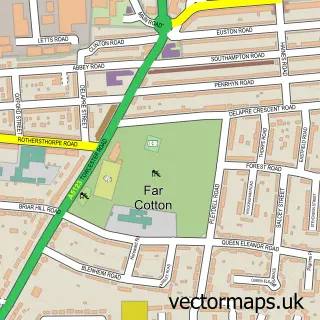
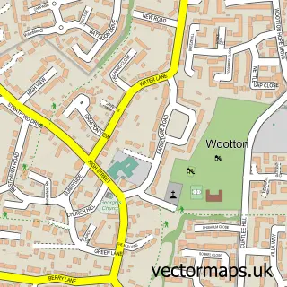
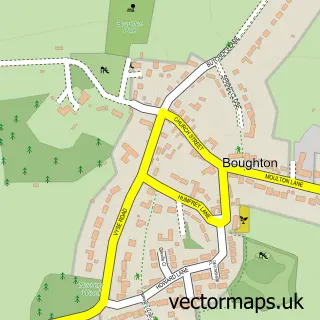
This Northampton street map is a detailed vector street map covering a 750m x 750m area. Select a larger area to create and download your own vector street map of Northampton.
The 750-metre map sample for Northampton covers 135 mapped buildings and approximately 50.5 km of road detail, of which 66 named roads are named. The immediate area includes 1 school, 1 GP surgery, with 15 within 2 miles, 24 pubs and 1 MOT station, with 43 within 2 miles. The wider area around Northampton features 15 tourism points of interest, 94 food and drink venues and 9 hotels. To create a larger or custom map of Northampton, the map builder lets you define your own coverage area and download editable SVG, PDF and PNG files.
Create a larger editable map of Northampton
Choose any area you need and generate a high-quality vector map instantly. Perfect for print, planning, design, business and personal use.

This Northampton street map in Northamptonshire is available as downloadable SVG, PDF and PNG map files, or as a printed map for planning, business, display, education, local information and design work. You can also create a larger custom map area using the map selector.
What this Northampton map sample shows
Northampton lies within Northampton Cp parish, part of Castle ward in the West Northamptonshire local authority area. The postcode geography for this area includes the NN postcode area, the NN1 postcode district and the NN1 1 postcode sector. Residents fall under the Nhs Northamptonshire Integrated Care Board for NHS services.
Local features near Northampton
Within 2 milesAmenities and services in and around Northampton.
Administrative and postcode information for Northampton
The local authority covering Northampton is West Northamptonshire, within the county of Northamptonshire. The settlement lies within Castle ward and Northampton Cp civil parish. The NN1 postcode district and NN1 1 postcode sector serve the immediate area. NHS provision in the area is delivered through Northampton General Hospital Nhs Trust.
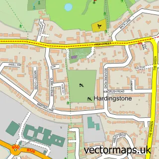
Nearby street map samples around Northampton

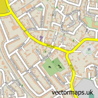
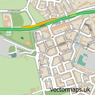
More street maps in Northamptonshire
750 metre map area coverage
Boundary, postcode and point of interest information for the 750m x 750m rectangle centred on this sample map.
Boundaries containing map centre
Constituency: Northampton North Boro Const
District: West Northamptonshire
Icb: NHS Northamptonshire ICB
Parish: Northampton CP
Police Force: northamptonshire
Postcode District: NN1
Postcode Sector: NN1 2
Ward: Castle Ward
Nearby boundaries intersecting sample
Postcode Sector: NN1 1, NN1 3
Postcode coverage
POI category counts
Beauty Salon: 48
Employment Agencies: 32
Clothing Store: 31
Professional Services: 31
Fast Food Restaurant: 28
Real Estate Agent: 27
Hair Salon: 26
Coffee Shop: 25
Pub: 24
Restaurant: 23
Sample points of interest
- St John's Halls
- Burghley Accountancy
- Moore Stephens LLP
- Rosemary Bookkeeping Northampton
- Nak Soo Muay Thai
- Rileys
- 5E Wellness Lab
- AJ Chinese Health Practice
- Acupuncture Northampton
- Acupuncture Northampton
- Chen's Acupuncture Clinic
- Be Rude Not Too
Create a larger editable map of Northampton
This sample shows only a 750 metre area. To create a larger map of Northampton, use our map builder to choose your own coverage area, add titles and download editable SVG, PDF and PNG files.
Create a custom map of Northampton