Vector Maps logo
Home Why it works Popular maps Districts Samples Customizer Create Your Map
VectorMaps.uk
Home Popular maps Districts Samples Customizer Create Your Map Privacy Disclaimer
Home / UK Maps / Northamptonshire / Duston Map

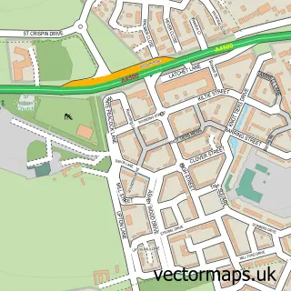
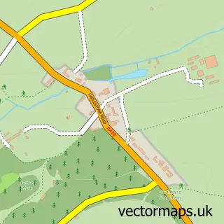
This Duston street map is a detailed vector street map covering a 750m x 750m area. Select a larger area to create and download your own vector street map of Duston.

Duston is a village in Northamptonshire, in the East Midlands of England. The settlement falls within the Northampton South parliamentary constituency. It is served by the NN5 postcode district, with NN5 6 as the local postcode sector.

The 750-metre map sample for Duston covers 612 mapped buildings and approximately 35.9 km of road detail, of which 40 named roads are named. The immediate area includes 1 GP surgery, with 4 within 2 miles, 3 pubs and 1 MOT station, with 28 within 2 miles. The wider area around Duston features 1 tourism point of interest and 4 food and drink venues. To create a larger or custom map of Duston, the map builder lets you define your own coverage area and download editable SVG, PDF and PNG files.

612Buildings
35.92 kmRoads
40Named roads
28,469Residents within 2 miles
Create your own

Create a larger editable map of Duston

Choose any area you need and generate a high-quality vector map instantly. Perfect for print, planning, design, business and personal use.

Choose any location
Editable SVG files
Any size up to A0
PDF, PNG & more
Instant download
High quality guaranteed
Create My Custom Map
Secure, private & no credit card required
Duston Vector Street Map
750m Sample
Duston vector street map sample showing roads, buildings and local features in a 750 metre preview area
Buy Duston Map Print from £12.95 Buy Duston Digital Map from £6

This Duston street map in Northamptonshire is available as downloadable SVG, PDF and PNG map files, or as a printed map for planning, business, display, education, local information and design work. You can also create a larger custom map area using the map selector.

What this Duston map sample shows

Duston lies within Duston Cp parish, part of Old Duston ward in the West Northamptonshire local authority area. The postcode geography for this area includes the NN postcode area, the NN5 postcode district and the NN5 6 postcode sector. Residents fall under the Nhs Northamptonshire Integrated Care Board for NHS services.

Local features near Duston

Within 2 miles

Amenities and services in and around Duston.

1 GP surgeries 4 within 2 miles
1 MOT stations 28 within 2 miles
1 Tourism & leisure
4 Food & drink
3 Pubs
7 Healthcare POIs
2 Vehicle services

Counts are approximate and based on publicly available data.

Administrative and postcode information for Duston

Duston lies within Duston Cp parish, part of Old Duston ward in the West Northamptonshire local authority area. The postcode geography for this area includes the NN postcode area, the NN5 postcode district and the NN5 6 postcode sector. Residents fall under the Nhs Northamptonshire Integrated Care Board for NHS services.

Parish Duston CP
Ward Old Duston
District / local authority West Northamptonshire
County Northamptonshire
Historic county Northamptonshire
Postcode district NN5
Postcode sector NN5 6
Parliamentary constituency Northampton South
Region East Midlands
Country England

Nearby street map samples around Duston

Street map sample of Northampton, Northamptonshire Northampton Town - Northamptonshire - 2.1 miles Street map sample of Milton Keynes, Buckinghamshire Milton Keynes City - Buckinghamshire - 16.0 miles Street map sample of Upton, Northamptonshire Upton Village - Northamptonshire - 0.6 miles Street map sample of Kislingbury, Northamptonshire Kislingbury Village - Northamptonshire - 1.8 miles Street map sample of Harpole, Northamptonshire Harpole Village - Northamptonshire - 1.9 miles Street map sample of Far Cotton, Northamptonshire Far Cotton Village - Northamptonshire - 2.1 miles Street map sample of Lower Harlestone, Northamptonshire Lower Harlestone Village - Northamptonshire - 2.3 miles Street map sample of Upper Harlestone, Northamptonshire Upper Harlestone Village - Northamptonshire - 2.4 miles Street map sample of Rothersthorpe, Northamptonshire Rothersthorpe Village - Northamptonshire - 2.8 miles Street map sample of Church Brampton, Northamptonshire Church Brampton Village - Northamptonshire - 3.0 miles

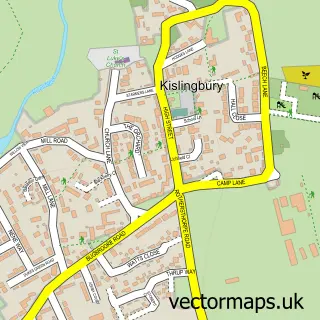
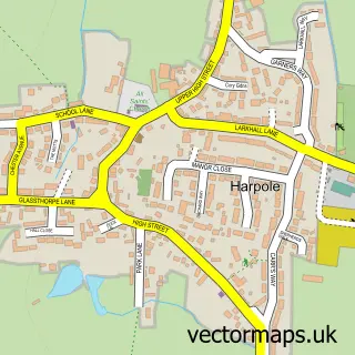
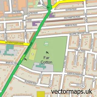
More street maps in Northamptonshire

Street map sample of Upton, Northamptonshire Upton Village - 0.6 miles Street map sample of Kislingbury, Northamptonshire Kislingbury Village - 1.8 miles Street map sample of Harpole, Northamptonshire Harpole Village - 1.9 miles Street map sample of Northampton, Northamptonshire Northampton Town - 2.1 miles Street map sample of Far Cotton, Northamptonshire Far Cotton Village - 2.1 miles

750 metre map area coverage

Boundary, postcode and point of interest information for the 750m x 750m rectangle centred on this sample map.

Boundaries containing map centre

Constituency: Northampton South Boro Const

District: West Northamptonshire

Icb: NHS Northamptonshire ICB

Parish: Duston CP

Police Force: northamptonshire

Postcode District: NN5

Postcode Sector: NN5 6

Ward: Duston Ward

Nearby boundaries intersecting sample

Parish: Upton CP

Postcode Sector: NN5 4

Ward: Upton Ward

Postcode coverage

NN5 NN5 6 NN5 4

POI category counts

Real Estate Agent: 5

Retirement Home: 5

Carpenter: 3

Dentist: 3

Pub: 3

Automotive Repair: 2

Banks: 2

Barber: 2

Beauty Product Supplier: 2

Catholic Church: 2

Sample points of interest

  • Taylors Apartments
  • Henna Art Direct UK Art Gallery
  • One Stop Northampton, Main Road Duston Atms
  • Innovation Security Systems Auto Electrical Repair
  • Duston Garage Ltd Automotive Repair
  • Pinewood House Motor Company Automotive Repair
  • Duston Village Bakery Bakery
  • Nationwide Building Society Bank Credit Union
  • NatWest Banks
  • Nationwide Banks
  • Alpha Barbers Barber
  • Barber Jo Barber

Create a larger editable map of Duston

This sample shows only a 750 metre area. To create a larger map of Duston, use our map builder to choose your own coverage area, add titles and download editable SVG, PDF and PNG files.

Create a custom map of Duston

Phone 01751 473136 | Copyright Vectormaps.uk 2026

Samples Customizer Privacy Disclaimer
Duston Vector Street Map
Duston enlarged street map sample showing a 750 metre preview area