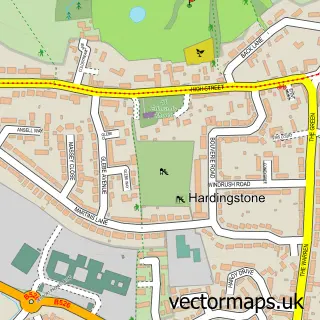
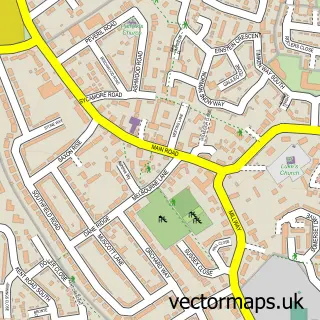
This Far Cotton street map is a detailed vector street map covering a 750m x 750m area. Select a larger area to create and download your own vector street map of Far Cotton.
The 750-metre map sample for Far Cotton covers 382 mapped buildings and approximately 40.3 km of road detail, of which 35 named roads are named. The immediate area includes 3 schools, 9 GP surgeries within 2 miles, 1 pub and 1 MOT station, with 41 within 2 miles. The wider area around Far Cotton features 1 tourism point of interest and 3 food and drink venues. To create a larger or custom map of Far Cotton, the map builder lets you define your own coverage area and download editable SVG, PDF and PNG files.
Create a larger editable map of Far Cotton
Choose any area you need and generate a high-quality vector map instantly. Perfect for print, planning, design, business and personal use.

This Far Cotton street map in Northamptonshire is available as downloadable SVG, PDF and PNG map files, or as a printed map for planning, business, display, education, local information and design work. You can also create a larger custom map area using the map selector.
What this Far Cotton map sample shows
Far Cotton lies within Far Cotton And Delapre Cp parish, part of Delapre And Briar Hill ward in the West Northamptonshire local authority area. The postcode geography for this area includes the NN postcode area, the NN4 postcode district and the NN4 8 postcode sector. Residents fall under the Nhs Northamptonshire Integrated Care Board for NHS services.
Local features near Far Cotton
Within 2 milesAmenities and services in and around Far Cotton.
Administrative and postcode information for Far Cotton
Far Cotton lies within Far Cotton And Delapre Cp parish, part of Delapre And Briar Hill ward in the West Northamptonshire local authority area. The postcode geography for this area includes the NN postcode area, the NN4 postcode district and the NN4 8 postcode sector. Residents fall under the Nhs Northamptonshire Integrated Care Board for NHS services.
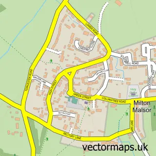
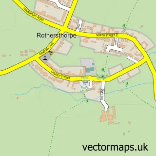
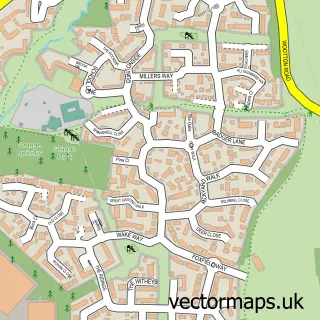
Nearby street map samples around Far Cotton


More street maps in Northamptonshire
750 metre map area coverage
Boundary, postcode and point of interest information for the 750m x 750m rectangle centred on this sample map.
Boundaries containing map centre
Constituency: Northampton South Boro Const
District: West Northamptonshire
Icb: NHS Northamptonshire ICB
Parish: Far Cotton and Delapre CP
Police Force: northamptonshire
Postcode District: NN4
Postcode Sector: NN4 8
Ward: Far Cotton, Delapre & Briar Hill Ward
Nearby boundaries intersecting sample
No additional intersecting boundaries found.
Postcode coverage
POI category counts
Convenience Store: 7
Building Supply Store: 5
Atms: 4
Automotive Repair: 3
Church Cathedral: 3
Flowers And Gifts Shop: 3
Grocery Store: 3
Hair Salon: 3
Package Locker: 3
Plumbing: 3
Sample points of interest
- B W P Accountancy Services
- Northampton Osteopaths
- St Mary the Virgin
- Peacock House Takeaway
- ATM (Post Office)
- Atm
- Shell Far Cotton, Cotton End
- The Cooperative Food (BF) Rothersthorpe Road (ERF)
- Cosmetic Autocare Ltd
- Inspiring Sky
- Car Bodyshop Repair Northampton
- R P Motors
Create a larger editable map of Far Cotton
This sample shows only a 750 metre area. To create a larger map of Far Cotton, use our map builder to choose your own coverage area, add titles and download editable SVG, PDF and PNG files.
Create a custom map of Far Cotton