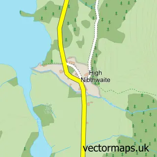
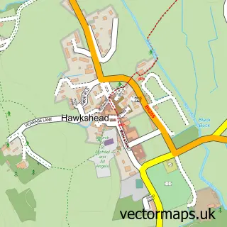
This Satterthwaite street map is a detailed vector street map covering a 750m x 750m area. Select a larger area to create and download your own vector street map of Satterthwaite.
The 750-metre map sample for Satterthwaite covers 50 mapped buildings and approximately 5.9 km of road detail. The immediate area includes 2 pubs. The wider area around Satterthwaite features 3 food and drink venues and 1 hotel. To create a larger or custom map of Satterthwaite, the map builder lets you define your own coverage area and download editable SVG, PDF and PNG files.
Create a larger editable map of Satterthwaite
Choose any area you need and generate a high-quality vector map instantly. Perfect for print, planning, design, business and personal use.

This Satterthwaite street map in Cumbria is available as downloadable SVG, PDF and PNG map files, or as a printed map for planning, business, display, education, local information and design work. You can also create a larger custom map area using the map selector.
What this Satterthwaite map sample shows
Satterthwaite lies within Satterthwaite Cp parish, part of Broughton & Coniston ward in the Westmorland And Furness local authority area. The postcode geography for this area includes the LA postcode area, the LA12 postcode district and the LA12 8 postcode sector. Residents fall under the Nhs Lancashire And South Cumbria Integrated Care Board for NHS services.
Local features near Satterthwaite
Within 2 milesAmenities and services in and around Satterthwaite.
Administrative and postcode information for Satterthwaite
Satterthwaite lies within Satterthwaite Cp parish, part of Broughton & Coniston ward in the Westmorland And Furness local authority area. The postcode geography for this area includes the LA postcode area, the LA12 postcode district and the LA12 8 postcode sector. Residents fall under the Nhs Lancashire And South Cumbria Integrated Care Board for NHS services.
Nearby street map samples around Satterthwaite

More street maps in Cumbria
750 metre map area coverage
Boundary, postcode and point of interest information for the 750m x 750m rectangle centred on this sample map.
Boundaries containing map centre
Constituency: Westmorland and Lonsdale Co Const
District: Westmorland and Furness
Icb: NHS Lancashire and South Cumbria ICB
Parish: Satterthwaite CP
Police Force: cumbria
Postcode District: LA12
Postcode Sector: LA12 8
Ward: Coniston and Hawkshead Ward
Nearby boundaries intersecting sample
No additional intersecting boundaries found.
Postcode coverage
POI category counts
Pub: 2
Accommodation: 1
Anglican Church: 1
Boot Camp: 1
Caterer: 1
Coffee Shop: 1
Hotel: 1
Lake: 1
Tea Room: 1
Sample points of interest
- Bobtail Cottage
- All Saints
- South Lakes Fitness
- Rock Cottage Dining
- Bowkerstead Farm Shop & Cafe
- Bogle Barn
- Satterthwaite, Lake District
- Eagles Head
- The Eagles Head
- Robert Fletcher Wildlife Artist Studio and Tea Room
Create a larger editable map of Satterthwaite
This sample shows only a 750 metre area. To create a larger map of Satterthwaite, use our map builder to choose your own coverage area, add titles and download editable SVG, PDF and PNG files.
Create a custom map of Satterthwaite