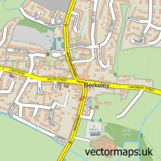
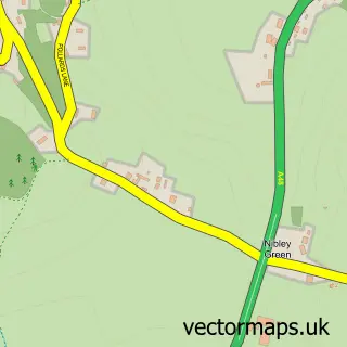
This Sharpness street map is a detailed vector street map covering a 750m x 750m area. Select a larger area to create and download your own vector street map of Sharpness.
The 750-metre map sample for Sharpness covers 162 mapped buildings and approximately 26.5 km of road detail, of which 11 named roads are named. The immediate area includes 2 MOT stations within 2 miles. The wider area around Sharpness features 1 tourism point of interest. To create a larger or custom map of Sharpness, the map builder lets you define your own coverage area and download editable SVG, PDF and PNG files.
Create a larger editable map of Sharpness
Choose any area you need and generate a high-quality vector map instantly. Perfect for print, planning, design, business and personal use.

This Sharpness street map in Gloucestershire is available as downloadable SVG, PDF and PNG map files, or as a printed map for planning, business, display, education, local information and design work. You can also create a larger custom map area using the map selector.
What this Sharpness map sample shows
Sharpness lies within Hamfallow Cp parish, part of Berkeley Vale ward in the Stroud District local authority area. The postcode geography for this area includes the GL postcode area, the GL13 postcode district and the GL13 9 postcode sector. Residents fall under the Nhs Gloucestershire Integrated Care Board for NHS services.
Local features near Sharpness
Within 2 milesAmenities and services in and around Sharpness.
Administrative and postcode information for Sharpness
The local authority covering Sharpness is Stroud District, within the county of Gloucestershire. The settlement lies within Berkeley Vale ward and Hamfallow Cp civil parish. The GL13 postcode district and GL13 9 postcode sector serve the immediate area. NHS provision in the area is delivered through Gloucestershire Hospitals Nhs Foundation Trust.
Nearby street map samples around Sharpness


More street maps in Gloucestershire
750 metre map area coverage
Boundary, postcode and point of interest information for the 750m x 750m rectangle centred on this sample map.
Boundaries containing map centre
Constituency: Stroud Co Const
County: Gloucestershire County
District: Stroud District
Icb: NHS Gloucestershire ICB
Parish: Hinton CP
Police Force: gloucestershire
Postcode District: GL13
Postcode Sector: GL13 9
Ward: Berkeley Vale Ward
Nearby boundaries intersecting sample
Parish: Hamfallow CP
Postcode coverage
POI category counts
Convenience Store: 2
Elementary School: 2
Grocery Store: 2
Metal Supplier: 2
Shipping Center: 2
Beauty Salon: 1
Bed And Breakfast: 1
Car Dealer: 1
Charity Organization: 1
Commercial Industrial: 1
Sample points of interest
- Kerri Crawshaw Permanent Makeup
- Pier View Hotel
- Classic Car Shows Plus Auto Jumble & Collector's Fairs
- Sharpness Community Swimming Trust
- Dragon Alfa Cement
- Cotswold Surfacing Co
- Costcutter
- Mace
- Round the Bend Driving Instruction
- Sharpness Primary School
- Sharpness Primary School
- Severnfresh
Create a larger editable map of Sharpness
This sample shows only a 750 metre area. To create a larger map of Sharpness, use our map builder to choose your own coverage area, add titles and download editable SVG, PDF and PNG files.
Create a custom map of Sharpness