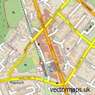
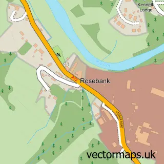
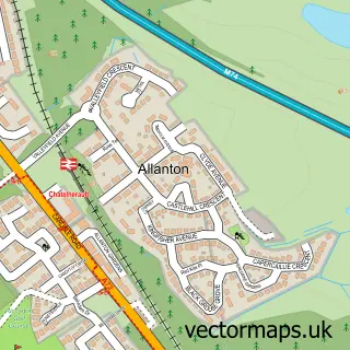
This Shawsburn street map is a detailed vector street map covering a 750m x 750m area. Select a larger area to create and download your own vector street map of Shawsburn.
The 750-metre map sample for Shawsburn covers 160 mapped buildings and approximately 11.9 km of road detail, of which 8 named roads are named. The immediate area includes 3 GP surgeries within 2 miles and 4 MOT stations within 2 miles. The wider area around Shawsburn features 1 hotel. To create a larger or custom map of Shawsburn, the map builder lets you define your own coverage area and download editable SVG, PDF and PNG files.
Create a larger editable map of Shawsburn
Choose any area you need and generate a high-quality vector map instantly. Perfect for print, planning, design, business and personal use.

This Shawsburn street map in Lanarkshire is available as downloadable SVG, PDF and PNG map files, or as a printed map for planning, business, display, education, local information and design work. You can also create a larger custom map area using the map selector.
What this Shawsburn map sample shows
Shawsburn lies within South Lanarkshire parish, part of Larkhall ward in the South Lanarkshire local authority area. The postcode geography for this area includes the ML postcode area, the ML9 postcode district and the ML9 2 postcode sector. Residents fall under the Lanarkshire for NHS services.
Local features near Shawsburn
Within 2 milesAmenities and services in and around Shawsburn.
Administrative and postcode information for Shawsburn
Shawsburn lies within South Lanarkshire parish, part of Larkhall ward in the South Lanarkshire local authority area. The postcode geography for this area includes the ML postcode area, the ML9 postcode district and the ML9 2 postcode sector. Residents fall under the Lanarkshire for NHS services.
Nearby street map samples around Shawsburn

More street maps in Lanarkshire
750 metre map area coverage
Boundary, postcode and point of interest information for the 750m x 750m rectangle centred on this sample map.
Boundaries containing map centre
Constituency: Hamilton and Clyde Valley Co Const
District: South Lanarkshire
Icb: Lanarkshire
Postcode District: ML9
Postcode Sector: ML9 3
Ward: Larkhall Ward
Nearby boundaries intersecting sample
Postcode Sector: ML9 2
Postcode coverage
POI category counts
Retirement Home: 4
Assisted Living Facility: 2
Automotive Repair: 2
Garbage Collection Service: 2
Animal Shelter: 1
B2b Electronic Equipment: 1
Car Dealer: 1
Catholic Church: 1
Gym: 1
Hair Salon: 1
Sample points of interest
- Macara Kennels
- Ashlea Court Care Home
- Welcare Homes
- Ayr Road Autos
- MSR Scotland LTD
- Redline Electronics
- CM Motor Group
- Dalserf
- Dunsmore Brothers
- Dunsmore Brothers
- South Lanarkshire Leisure
- Cinnamane Hair Boutique
Create a larger editable map of Shawsburn
This sample shows only a 750 metre area. To create a larger map of Shawsburn, use our map builder to choose your own coverage area, add titles and download editable SVG, PDF and PNG files.
Create a custom map of Shawsburn