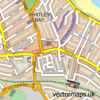
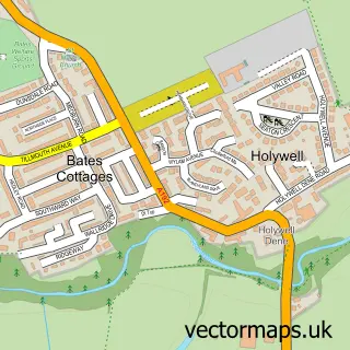
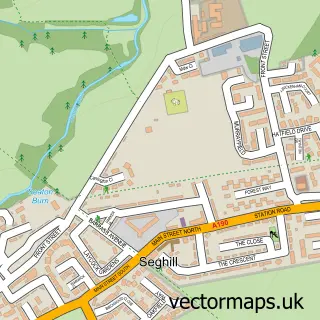
This Shiremoor street map is a detailed vector street map covering a 750m x 750m area. Select a larger area to create and download your own vector street map of Shiremoor.
The 750-metre map sample for Shiremoor covers 441 mapped buildings and approximately 22.7 km of road detail, of which 44 named roads are named. The immediate area includes 2 schools, 1 railway station, 1 GP surgery, with 3 within 2 miles and 1 MOT station, with 22 within 2 miles. The wider area around Shiremoor features 1 tourism point of interest and 3 food and drink venues. To create a larger or custom map of Shiremoor, the map builder lets you define your own coverage area and download editable SVG, PDF and PNG files.
Create a larger editable map of Shiremoor
Choose any area you need and generate a high-quality vector map instantly. Perfect for print, planning, design, business and personal use.

This Shiremoor street map in Tyne & Wear is available as downloadable SVG, PDF and PNG map files, or as a printed map for planning, business, display, education, local information and design work. You can also create a larger custom map area using the map selector.
What this Shiremoor map sample shows
Shiremoor lies within North Tyneside District (B) parish, part of Valley ward in the North Tyneside District (B) local authority area. The postcode geography for this area includes the NE postcode area, the NE27 postcode district and the NE27 0 postcode sector. Residents fall under the Nhs North East And North Cumbria Integrated Care Board for NHS services.
Local features near Shiremoor
Within 2 milesAmenities and services in and around Shiremoor.
Administrative and postcode information for Shiremoor
The local authority covering Shiremoor is North Tyneside District (B), within the county of Tyne & Wear. The settlement lies within Valley ward and North Tyneside District (B) civil parish. The NE27 postcode district and NE27 0 postcode sector serve the immediate area. NHS provision in the area is delivered through Northumbria Healthcare Nhs Foundation Trust.
Nearby street map samples around Shiremoor

More street maps in Tyne & Wear
750 metre map area coverage
Boundary, postcode and point of interest information for the 750m x 750m rectangle centred on this sample map.
Boundaries containing map centre
Constituency: Cramlington and Killingworth Co Const
District: North Tyneside District (B)
Icb: NHS North East and North Cumbria ICB
Police Force: northumberland
Postcode District: NE27
Postcode Sector: NE27 0
Ward: Shiremoor Ward
Nearby boundaries intersecting sample
Ward: New York & Murton Ward
Postcode coverage
POI category counts
Convenience Store: 5
Charity Organization: 4
Doctor: 4
Atms: 3
Coffee Shop: 3
Community Services Non Profits: 3
Automotive Repair: 2
Building Supply Store: 2
Church Cathedral: 2
Community Center: 2
Sample points of interest
- GetMediaWise
- Goldenlight Sacred Energies
- Bamburgh Crescent
- ATM (Post Office)
- Payzone
- Snax 24 - Shiremoor 645 (SWAP), Shiremoor
- Foster's Hand Car Wash And Valet Centre
- North East Garages
- Indievator Gaming
- Shiremoor Tavern Private Function Rooms
- Traditions barbers
- Beauty Defined
Create a larger editable map of Shiremoor
This sample shows only a 750 metre area. To create a larger map of Shiremoor, use our map builder to choose your own coverage area, add titles and download editable SVG, PDF and PNG files.
Create a custom map of Shiremoor