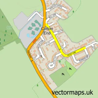
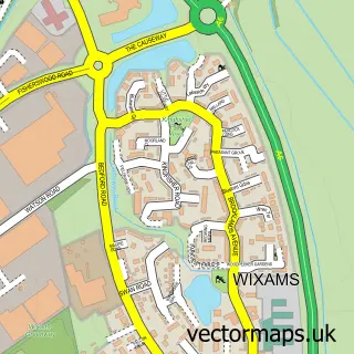
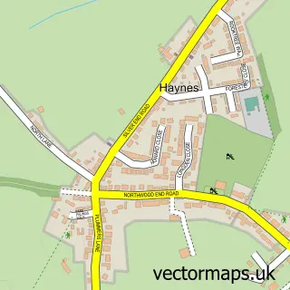
This Shortstown street map is a detailed vector street map covering a 750m x 750m area. Select a larger area to create and download your own vector street map of Shortstown.
The 750-metre map sample for Shortstown covers 483 mapped buildings and approximately 20.4 km of road detail, of which 50 named roads are named. The immediate area includes 1 school, 1 GP surgery within 2 miles and 17 MOT stations within 2 miles. The wider area around Shortstown features 2 tourism points of interest and 4 food and drink venues. To create a larger or custom map of Shortstown, the map builder lets you define your own coverage area and download editable SVG, PDF and PNG files.
Create a larger editable map of Shortstown
Choose any area you need and generate a high-quality vector map instantly. Perfect for print, planning, design, business and personal use.

This Shortstown street map in Bedfordshire is available as downloadable SVG, PDF and PNG map files, or as a printed map for planning, business, display, education, local information and design work. You can also create a larger custom map area using the map selector.
What this Shortstown map sample shows
Shortstown lies within Shortstown Cp parish, part of Eastcotts ward in the Bedford (B) local authority area. The postcode geography for this area includes the MK postcode area, the MK42 postcode district and the MK42 0 postcode sector. Residents fall under the Nhs Bedfordshire, Luton And Milton Keynes Integrated Care Board for NHS services.
Local features near Shortstown
Within 2 milesAmenities and services in and around Shortstown.
Administrative and postcode information for Shortstown
The local authority covering Shortstown is Bedford (B), within the county of Bedfordshire. The settlement lies within Eastcotts ward and Shortstown Cp civil parish. The MK42 postcode district and MK42 0 postcode sector serve the immediate area. NHS provision in the area is delivered through Bedfordshire Hospitals Nhs Foundation Trust.
Nearby street map samples around Shortstown
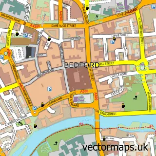

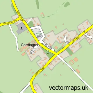
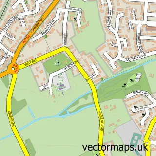
More street maps in Bedfordshire
750 metre map area coverage
Boundary, postcode and point of interest information for the 750m x 750m rectangle centred on this sample map.
Boundaries containing map centre
Constituency: North Bedfordshire Co Const
District: Bedford (B)
Icb: NHS Central East ICB
Parish: Shortstown CP
Police Force: bedfordshire
Postcode District: MK42
Postcode Sector: MK42 0
Ward: Shortstown Ward
Nearby boundaries intersecting sample
No additional intersecting boundaries found.
Postcode coverage
POI category counts
Convenience Store: 3
Building Supply Store: 2
Cafe: 2
Construction Services: 2
Food Delivery Service: 2
Real Estate Agent: 2
Rental Kiosks: 2
Weight Loss Center: 2
Alternative Medicine: 1
Automotive Repair: 1
Sample points of interest
- Divine Harmony
- Elms MINI Bedford
- Always Flawless Beauty & Weight Loss Specialist
- Pamela Polson
- MGC Building
- UPVC by Design
- Artisan Hardscape Solutions Ltd.
- Friendly Nettle Cafe
- The Hangar Cafe & Bar
- Costa Express
- Shortstown Village Hall
- LNP Scaffolding Services
Create a larger editable map of Shortstown
This sample shows only a 750 metre area. To create a larger map of Shortstown, use our map builder to choose your own coverage area, add titles and download editable SVG, PDF and PNG files.
Create a custom map of Shortstown