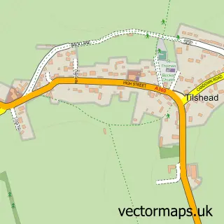
This Shrewton street map is a detailed vector street map covering a 750m x 750m area. Select a larger area to create and download your own vector street map of Shrewton.
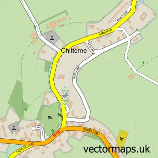
The 750-metre map sample for Shrewton covers 320 mapped buildings and approximately 10.4 km of road detail, of which 22 named roads are named. The immediate area includes 1 school and 1 MOT station, with 2 within 2 miles. The wider area around Shrewton features 2 hotels and 1 campsite within 2 miles. To create a larger or custom map of Shrewton, the map builder lets you define your own coverage area and download editable SVG, PDF and PNG files.
Create a larger editable map of Shrewton
Choose any area you need and generate a high-quality vector map instantly. Perfect for print, planning, design, business and personal use.

This Shrewton street map in Wiltshire is available as downloadable SVG, PDF and PNG map files, or as a printed map for planning, business, display, education, local information and design work. You can also create a larger custom map area using the map selector.
What this Shrewton map sample shows
Shrewton lies within Shrewton Cp parish, part of Till And Wylye Valley ward in the Wiltshire local authority area. The postcode geography for this area includes the SP postcode area, the SP3 postcode district and the SP3 4 postcode sector. Residents fall under the Nhs Bath And North East Somerset, Swindon And Wiltshire Integrated Care Board for NHS services.
Local features near Shrewton
Within 2 milesAmenities and services in and around Shrewton.
Administrative and postcode information for Shrewton
Shrewton lies within Shrewton Cp parish, part of Till And Wylye Valley ward in the Wiltshire local authority area. The postcode geography for this area includes the SP postcode area, the SP3 postcode district and the SP3 4 postcode sector. Residents fall under the Nhs Bath And North East Somerset, Swindon And Wiltshire Integrated Care Board for NHS services.
Nearby street map samples around Shrewton

More street maps in Wiltshire
750 metre map area coverage
Boundary, postcode and point of interest information for the 750m x 750m rectangle centred on this sample map.
Boundaries containing map centre
Constituency: East Wiltshire Co Const
District: Wiltshire
Icb: NHS Bath and North East Somerset Swindon and Wiltshire ICB
Parish: Shrewton CP
Police Force: wiltshire
Postcode District: SP3
Postcode Sector: SP3 4
Nearby boundaries intersecting sample
No additional intersecting boundaries found.
Postcode coverage
POI category counts
Automotive Repair: 3
Gas Station: 2
Hotel: 2
Physical Therapy: 2
Professional Services: 2
Atms: 1
Butcher Shop: 1
Charity Organization: 1
Church Cathedral: 1
Construction Services: 1
Sample points of interest
- The Southern Co-Operative Shrewton High Street, Shrewton
- Bridge Garage
- FBB Landrovers
- The Bridge Garage
- Billy Baxter's
- Shrewton Pre-school
- St Mary's Church
- Cruse T G
- The Co-operative Shrewton
- Willow Cottage Holiday Rental
- The Till Orchard Surgery, High Street
- Airborne Visual Solutions Ltd.
Create a larger editable map of Shrewton
This sample shows only a 750 metre area. To create a larger map of Shrewton, use our map builder to choose your own coverage area, add titles and download editable SVG, PDF and PNG files.
Create a custom map of Shrewton