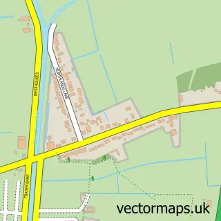
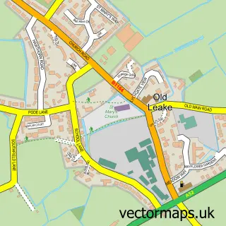
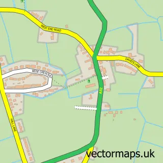
This Sibsey street map is a detailed vector street map covering a 750m x 750m area. Select a larger area to create and download your own vector street map of Sibsey.
The 750-metre map sample for Sibsey covers 366 mapped buildings and approximately 12.7 km of road detail, of which 20 named roads are named. The immediate area includes 1 school and 1 pub. The wider area around Sibsey features 1 food and drink venue. To create a larger or custom map of Sibsey, the map builder lets you define your own coverage area and download editable SVG, PDF and PNG files.
Create a larger editable map of Sibsey
Choose any area you need and generate a high-quality vector map instantly. Perfect for print, planning, design, business and personal use.

This Sibsey street map in Lincolnshire is available as downloadable SVG, PDF and PNG map files, or as a printed map for planning, business, display, education, local information and design work. You can also create a larger custom map area using the map selector.
What this Sibsey map sample shows
Sibsey lies within Sibsey Cp parish, part of Sibsey & Stickney ward in the East Lindsey District local authority area. The postcode geography for this area includes the PE postcode area, the PE22 postcode district and the PE22 0 postcode sector. Residents fall under the Nhs Lincolnshire Integrated Care Board for NHS services.
Local features near Sibsey
Within 2 milesAmenities and services in and around Sibsey.
Administrative and postcode information for Sibsey
Sibsey lies within Sibsey Cp parish, part of Sibsey & Stickney ward in the East Lindsey District local authority area. The postcode geography for this area includes the PE postcode area, the PE22 postcode district and the PE22 0 postcode sector. Residents fall under the Nhs Lincolnshire Integrated Care Board for NHS services.
Nearby street map samples around Sibsey

More street maps in Lincolnshire
750 metre map area coverage
Boundary, postcode and point of interest information for the 750m x 750m rectangle centred on this sample map.
Boundaries containing map centre
Constituency: Boston and Skegness Co Const
County: Lincolnshire County
District: East Lindsey District
Icb: NHS Lincolnshire ICB
Parish: Sibsey CP
Police Force: lincolnshire
Postcode District: PE22
Postcode Sector: PE22 0
Ward: Sibsey & Stickney Ward
Nearby boundaries intersecting sample
No additional intersecting boundaries found.
Postcode coverage
POI category counts
Convenience Store: 4
Anglican Church: 2
Chimney Sweep: 2
Elementary School: 2
Post Office: 2
Appliance Store: 1
Beauty And Spa: 1
Child Care And Day Care: 1
Community Center: 1
Electrician: 1
Sample points of interest
- St Margaret's Church
- St Margaret's Church, Sibsey
- Country Stoves. Stoves & Sweeps
- Alix Malone Beauty & Aesthetics
- Em's Childminding-sibsey
- Beagles Chimneys
- Stoves and Sweeps
- Sibsey Farmers Market
- Costcutter
- Londis
- Londis LONDIS - SIBSEY
- SPAR
Create a larger editable map of Sibsey
This sample shows only a 750 metre area. To create a larger map of Sibsey, use our map builder to choose your own coverage area, add titles and download editable SVG, PDF and PNG files.
Create a custom map of Sibsey