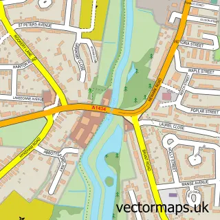
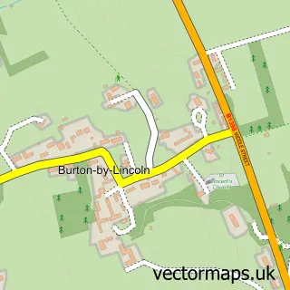
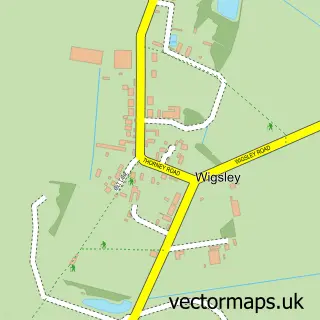
This Skellingthorpe street map is a detailed vector street map covering a 750m x 750m area. Select a larger area to create and download your own vector street map of Skellingthorpe.
The 750-metre map sample for Skellingthorpe covers 435 mapped buildings and approximately 15.4 km of road detail, of which 31 named roads are named. The immediate area includes 1 school, 2 GP surgeries within 2 miles and 1 pub. The wider area around Skellingthorpe features 1 tourism point of interest and 2 food and drink venues. To create a larger or custom map of Skellingthorpe, the map builder lets you define your own coverage area and download editable SVG, PDF and PNG files.
Create a larger editable map of Skellingthorpe
Choose any area you need and generate a high-quality vector map instantly. Perfect for print, planning, design, business and personal use.

This Skellingthorpe street map in Lincolnshire is available as downloadable SVG, PDF and PNG map files, or as a printed map for planning, business, display, education, local information and design work. You can also create a larger custom map area using the map selector.
What this Skellingthorpe map sample shows
Skellingthorpe lies within Skellingthorpe Cp parish, part of Skellingthorpe ward in the North Kesteven District local authority area. The postcode geography for this area includes the LN postcode area, the LN6 postcode district and the LN6 5 postcode sector. Residents fall under the Nhs Lincolnshire Integrated Care Board for NHS services.
Local features near Skellingthorpe
Within 2 milesAmenities and services in and around Skellingthorpe.
Administrative and postcode information for Skellingthorpe
The local authority covering Skellingthorpe is North Kesteven District, within the county of Lincolnshire. The settlement lies within Skellingthorpe ward and Skellingthorpe Cp civil parish. The LN6 postcode district and LN6 5 postcode sector serve the immediate area. NHS provision in the area is delivered through United Lincolnshire Hospitals Nhs Trust.
Nearby street map samples around Skellingthorpe

More street maps in Lincolnshire
750 metre map area coverage
Boundary, postcode and point of interest information for the 750m x 750m rectangle centred on this sample map.
Boundaries containing map centre
Constituency: Lincoln Boro Const
County: Lincolnshire County
District: North Kesteven District
Icb: NHS Lincolnshire ICB
Parish: Skellingthorpe CP
Police Force: lincolnshire
Postcode District: LN6
Postcode Sector: LN6 5
Ward: Skellingthorpe & Eagle Ward
Nearby boundaries intersecting sample
Postcode Sector: LN6 4
Postcode coverage
POI category counts
Convenience Store: 2
Driving School: 2
Elementary School: 2
Pharmacy: 2
Post Office: 2
Accommodation: 1
Acupuncture: 1
Anglican Church: 1
Arts And Crafts: 1
Arts And Entertainment: 1
Sample points of interest
- Skellingthorpe Village
- MAC Acupuncture
- St Lawrence, Skellingthorpe
- Handcrafted Hat Blocks
- skellingthorpe Lincoln
- Lincolnshire Co-op - Skellingthorpe (Int)
- Mayo Crane Hire Ltd.
- Candu Ict
- A.L.S. Fencing & Landscaping
- Sharpe Kitchens
- Dragonfly Sweet Company
- Buttercup Daycare
Create a larger editable map of Skellingthorpe
This sample shows only a 750 metre area. To create a larger map of Skellingthorpe, use our map builder to choose your own coverage area, add titles and download editable SVG, PDF and PNG files.
Create a custom map of Skellingthorpe