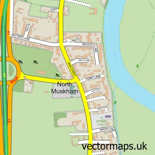
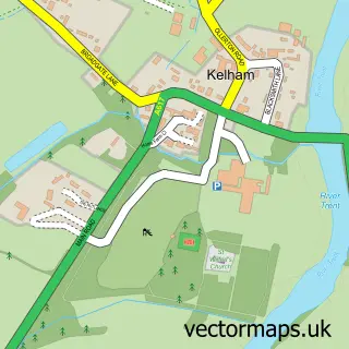
This South Muskham street map is a detailed vector street map covering a 750m x 750m area. Select a larger area to create and download your own vector street map of South Muskham.
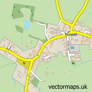
The 750-metre map sample for South Muskham covers 121 mapped buildings and approximately 17.2 km of road detail, of which 9 named roads are named. The immediate area includes 7 MOT stations within 2 miles. The wider area around South Muskham features 1 campsite within 2 miles. To create a larger or custom map of South Muskham, the map builder lets you define your own coverage area and download editable SVG, PDF and PNG files.
Create a larger editable map of South Muskham
Choose any area you need and generate a high-quality vector map instantly. Perfect for print, planning, design, business and personal use.

This South Muskham street map in Nottinghamshire is available as downloadable SVG, PDF and PNG map files, or as a printed map for planning, business, display, education, local information and design work. You can also create a larger custom map area using the map selector.
What this South Muskham map sample shows
South Muskham lies within South Muskham Cp parish, part of Muskham ward in the Newark And Sherwood District local authority area. The postcode geography for this area includes the NG postcode area, the NG23 postcode district and the NG23 6 postcode sector. Residents fall under the Nhs Nottingham And Nottinghamshire Integrated Care Board for NHS services.
Local features near South Muskham
Within 2 milesAmenities and services in and around South Muskham.
Administrative and postcode information for South Muskham
South Muskham lies within South Muskham Cp parish, part of Muskham ward in the Newark And Sherwood District local authority area. The postcode geography for this area includes the NG postcode area, the NG23 postcode district and the NG23 6 postcode sector. Residents fall under the Nhs Nottingham And Nottinghamshire Integrated Care Board for NHS services.
Nearby street map samples around South Muskham

More street maps in Nottinghamshire
750 metre map area coverage
Boundary, postcode and point of interest information for the 750m x 750m rectangle centred on this sample map.
Boundaries containing map centre
Constituency: Newark Co Const
County: Nottinghamshire County
District: Newark and Sherwood District
Icb: NHS Nottingham and Nottinghamshire ICB
Parish: South Muskham CP
Police Force: nottinghamshire
Postcode District: NG23
Postcode Sector: NG23 6
Ward: Muskham Ward
Nearby boundaries intersecting sample
No additional intersecting boundaries found.
Postcode coverage
POI category counts
Beauty Salon: 1
Building Supply Store: 1
Butcher Shop: 1
Church Cathedral: 1
Community Services Non Profits: 1
Engineering Services: 1
Movie Television Studio: 1
Musical Instrument Store: 1
Preschool: 1
Town Hall: 1
Sample points of interest
- The Muskham Hair and Beauty Clinic
- J & P Builders Merchants
- The Muskham Pantry
- St Wilfrid's Church
- Newark & District Photographic Society
- M A Brown Steel Services Ltd.
- Vampires Rock
- Riverside Violins
- Breedon House Childrens Centre
- South Muskham and Little Carlton Village Hall
Create a larger editable map of South Muskham
This sample shows only a 750 metre area. To create a larger map of South Muskham, use our map builder to choose your own coverage area, add titles and download editable SVG, PDF and PNG files.
Create a custom map of South Muskham