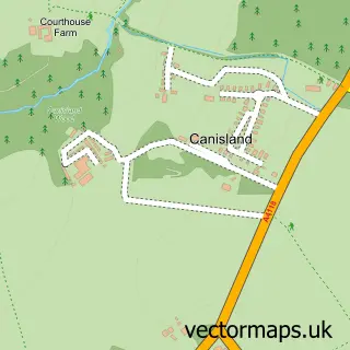
This Southgate street map is a detailed vector street map covering a 750m x 750m area. Select a larger area to create and download your own vector street map of Southgate.
The 750-metre map sample for Southgate covers 308 mapped buildings and approximately 10.7 km of road detail, of which 16 named roads are named. The immediate area includes 1 GP surgery within 2 miles and 2 pubs. The wider area around Southgate features 2 tourism points of interest, 5 food and drink venues and 1 campsite within 2 miles. To create a larger or custom map of Southgate, the map builder lets you define your own coverage area and download editable SVG, PDF and PNG files.
Create a larger editable map of Southgate
Choose any area you need and generate a high-quality vector map instantly. Perfect for print, planning, design, business and personal use.

This Southgate street map in West Glamorgan is available as downloadable SVG, PDF and PNG map files, or as a printed map for planning, business, display, education, local information and design work. You can also create a larger custom map area using the map selector.
What this Southgate map sample shows
Southgate lies within Pennard Community parish, part of Pennard ward in the Abertawe - Swansea local authority area. The postcode geography for this area includes the SA postcode area, the SA3 postcode district and the SA3 2 postcode sector. Residents fall under the Swansea Bay University Local Health Board for NHS services.
Local features near Southgate
Within 2 milesAmenities and services in and around Southgate.
Administrative and postcode information for Southgate
Southgate lies within Pennard Community parish, part of Pennard ward in the Abertawe - Swansea local authority area. The postcode geography for this area includes the SA postcode area, the SA3 postcode district and the SA3 2 postcode sector. Residents fall under the Swansea Bay University Local Health Board for NHS services.
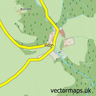
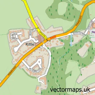
Nearby street map samples around Southgate


More street maps in West Glamorgan
750 metre map area coverage
Boundary, postcode and point of interest information for the 750m x 750m rectangle centred on this sample map.
Boundaries containing map centre
Constituency: Gower Co Const
District: Abertawe - Swansea
Icb: Abertawe Bro Morgannwg University
Parish: Pennard Community
Police Force: south wales
Postcode District: SA3
Postcode Sector: SA3 2
Nearby boundaries intersecting sample
No additional intersecting boundaries found.
Postcode coverage
POI category counts
Holiday Rental Home: 2
Post Office: 2
Pub: 2
Alternative Medicine: 1
Attractions And Activities: 1
Automotive Repair: 1
Cafe: 1
Car Dealer: 1
Coffee Shop: 1
Convenience Store: 1
Sample points of interest
- The Circle Osteopathic Clinic
- Pennard, Pwll Du and Bishopston Valley
- Southgate Service Station
- The Hub
- Cameron Grant International
- Three Cliffs Coffee Shop
- Pennard Stores
- Post Office Travel Money
- Planet Sounds Mobile Disco
- Potential Energy Swansea
- Pennard Golf Club
- Sean Pearson Golf Academy
Create a larger editable map of Southgate
This sample shows only a 750 metre area. To create a larger map of Southgate, use our map builder to choose your own coverage area, add titles and download editable SVG, PDF and PNG files.
Create a custom map of Southgate