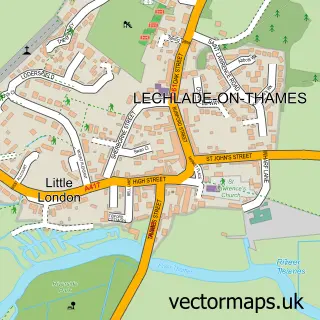
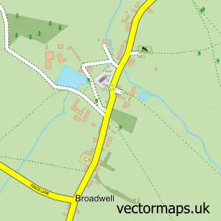
This Southrop street map is a detailed vector street map covering a 750m x 750m area. Select a larger area to create and download your own vector street map of Southrop.
The 750-metre map sample for Southrop covers 124 mapped buildings and approximately 14.2 km of road detail, of which 5 named roads are named. The immediate area includes 1 school and 1 pub. The wider area around Southrop features 1 food and drink venue. To create a larger or custom map of Southrop, the map builder lets you define your own coverage area and download editable SVG, PDF and PNG files.
Create a larger editable map of Southrop
Choose any area you need and generate a high-quality vector map instantly. Perfect for print, planning, design, business and personal use.

This Southrop street map in Gloucestershire is available as downloadable SVG, PDF and PNG map files, or as a printed map for planning, business, display, education, local information and design work. You can also create a larger custom map area using the map selector.
What this Southrop map sample shows
Southrop lies within Southrop Cp parish, part of Coln Valley ward in the Cotswold District local authority area. The postcode geography for this area includes the GL postcode area, the GL7 postcode district and the GL7 3 postcode sector. Residents fall under the Nhs Gloucestershire Integrated Care Board for NHS services.
Local features near Southrop
Within 2 milesAmenities and services in and around Southrop.
Administrative and postcode information for Southrop
Southrop lies within Southrop Cp parish, part of Coln Valley ward in the Cotswold District local authority area. The postcode geography for this area includes the GL postcode area, the GL7 postcode district and the GL7 3 postcode sector. Residents fall under the Nhs Gloucestershire Integrated Care Board for NHS services.
Nearby street map samples around Southrop

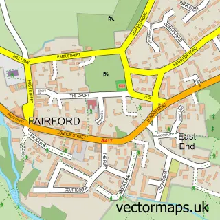
More street maps in Gloucestershire
750 metre map area coverage
Boundary, postcode and point of interest information for the 750m x 750m rectangle centred on this sample map.
Boundaries containing map centre
Constituency: North Cotswolds Co Const
County: Gloucestershire County
District: Cotswold District
Icb: NHS Gloucestershire ICB
Parish: Southrop CP
Police Force: gloucestershire
Postcode District: GL7
Postcode Sector: GL7 3
Ward: Coln Valley Ward
Nearby boundaries intersecting sample
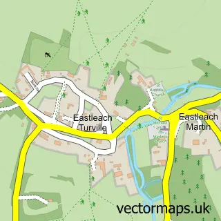
Parish: Eastleach CP
Postcode coverage
POI category counts
Automotive Repair: 1
British Restaurant: 1
Charity Organization: 1
Church Cathedral: 1
Cottage: 1
Elementary School: 1
Fabric Store: 1
Post Office: 1
Pub: 1
Resort: 1
Sample points of interest
- Brooklands Garage
- The Ox Barn, Southrop
- Southrop Village Fete
- St Peter's Church, Southrop
- Culls Cottage
- Southrop Church of England Primary School
- Teasel at Southrop
- Post Office
- The Swan at Southrop
- Thyme
Create a larger editable map of Southrop
This sample shows only a 750 metre area. To create a larger map of Southrop, use our map builder to choose your own coverage area, add titles and download editable SVG, PDF and PNG files.
Create a custom map of Southrop