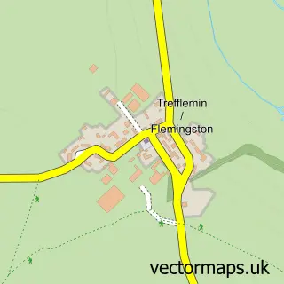
This St Hilary street map is a detailed vector street map covering a 750m x 750m area. Select a larger area to create and download your own vector street map of St Hilary.
The 750-metre map sample for St Hilary covers 96 mapped buildings and approximately 14.1 km of road detail, of which 1 named road are named. The immediate area includes 1 pub and 1 MOT station within 2 miles. The wider area around St Hilary features 1 tourism point of interest and 1 food and drink venue. To create a larger or custom map of St Hilary, the map builder lets you define your own coverage area and download editable SVG, PDF and PNG files.
Create a larger editable map of St Hilary
Choose any area you need and generate a high-quality vector map instantly. Perfect for print, planning, design, business and personal use.

This St Hilary street map in South Glamorgan is available as downloadable SVG, PDF and PNG map files, or as a printed map for planning, business, display, education, local information and design work. You can also create a larger custom map area using the map selector.
What this St Hilary map sample shows
St Hilary lies within Llanfair Community parish, part of Cowbridge ward in the Bro Morgannwg - The Vale Of Glamorgan local authority area. The postcode geography for this area includes the CF postcode area, the CF71 postcode district and the CF71 7 postcode sector. Residents fall under the Cardiff And Vale University Health Board for NHS services.
Local features near St Hilary
Within 2 milesAmenities and services in and around St Hilary.
Administrative and postcode information for St Hilary
The local authority covering St Hilary is Bro Morgannwg - The Vale Of Glamorgan, within the county of South Glamorgan. The settlement lies within Cowbridge ward and Llanfair Community civil parish. The CF71 postcode district and CF71 7 postcode sector serve the immediate area. NHS provision in the area is delivered through Cardiff And Vale University Health Board.
Nearby street map samples around St Hilary


More street maps in South Glamorgan
750 metre map area coverage
Boundary, postcode and point of interest information for the 750m x 750m rectangle centred on this sample map.
Boundaries containing map centre
Constituency: Vale of Glamorgan Co Const
District: Bro Morgannwg - the Vale of Glamorgan
Icb: Cardiff and Vale University
Parish: Llanfair Community
Police Force: south wales
Postcode District: CF71
Postcode Sector: CF71 7
Nearby boundaries intersecting sample
Parish: Cowbridge with Llanblethian Community
Postcode coverage
POI category counts
Assisted Living Facility: 2
Church Cathedral: 2
Art Gallery: 1
Broadcasting Media Production: 1
Gas Station: 1
Gym: 1
Music Production: 1
Park: 1
Pub: 1
Retirement Home: 1
Sample points of interest
- Coed Hills Rural Artspace
- Manor House Nursing Home
- The Manor House Nursing Home
- Dragon Radio
- Church of St Hilary
- St Hilary's Church
- Esso
- St Hilary Village Hall
- Hafod Mastering
- Henso Forest Camping and Caravan Park
- The Bush Inn
- The Manor House St Hilary
Create a larger editable map of St Hilary
This sample shows only a 750 metre area. To create a larger map of St Hilary, use our map builder to choose your own coverage area, add titles and download editable SVG, PDF and PNG files.
Create a custom map of St Hilary