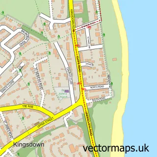
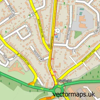
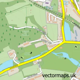
This St. Margaret's at Cliffe street map is a detailed vector street map covering a 750m x 750m area. Select a larger area to create and download your own vector street map of St. Margaret's at Cliffe.
The 750-metre map sample for St. Margaret's at Cliffe covers 361 mapped buildings and approximately 12.1 km of road detail, of which 22 named roads are named. The immediate area includes 2 schools and 1 pub. The wider area around St. Margaret's at Cliffe features 2 tourism points of interest, 2 food and drink venues and 2 hotels. To create a larger or custom map of St. Margaret's at Cliffe, the map builder lets you define your own coverage area and download editable SVG, PDF and PNG files.
Create a larger editable map of St. Margaret's at Cliffe
Choose any area you need and generate a high-quality vector map instantly. Perfect for print, planning, design, business and personal use.

This St. Margaret's at Cliffe street map in Kent is available as downloadable SVG, PDF and PNG map files, or as a printed map for planning, business, display, education, local information and design work. You can also create a larger custom map area using the map selector.
What this St. Margaret's at Cliffe map sample shows
St. Margaret's at Cliffe lies within St. Margaret's At Cliffe Cp parish, part of Guston, Kingsdown & St Margaret's-At-Cliffe ward in the Dover District local authority area. The postcode geography for this area includes the CT postcode area, the CT15 postcode district and the CT15 6 postcode sector. Residents fall under the Nhs Kent And Medway Integrated Care Board for NHS services.
Local features near St. Margaret's at Cliffe
Within 2 milesAmenities and services in and around St. Margaret's at Cliffe.
Administrative and postcode information for St. Margaret's at Cliffe
St. Margaret's at Cliffe lies within St. Margaret's At Cliffe Cp parish, part of Guston, Kingsdown & St Margaret's-At-Cliffe ward in the Dover District local authority area. The postcode geography for this area includes the CT postcode area, the CT15 postcode district and the CT15 6 postcode sector. Residents fall under the Nhs Kent And Medway Integrated Care Board for NHS services.
Nearby street map samples around St. Margaret's at Cliffe

More street maps in Kent
750 metre map area coverage
Boundary, postcode and point of interest information for the 750m x 750m rectangle centred on this sample map.
Boundaries containing map centre
Constituency: Dover and Deal Co Const
County: Kent County
District: Dover District
Icb: NHS Kent and Medway ICB
Parish: St. Margaret's At Cliffe CP
Police Force: kent
Postcode District: CT15
Postcode Sector: CT15 6
Ward: Guston, Kingsdown & St. Margaret's-at-Cliffe Ward
Nearby boundaries intersecting sample
No additional intersecting boundaries found.
Postcode coverage
POI category counts
Beach: 2
Beauty Salon: 2
Hotel: 2
Professional Services: 2
Scout Hall: 2
Shipping Center: 2
Anglican Church: 1
Attractions And Activities: 1
Auto Electrical Repair: 1
Bar: 1
Sample points of interest
- St Margaret of Antioch
- Alexander Field
- David R Adams Electrical Services
- The Hope Inn
- St Margaret-at-Cliffe
- St. Margarets Hall
- Sally Fielding Beauty Therapist
- Salon beau
- Michael Rix Building Ltd
- Hazel Addley Coaching
- DRS Shopfitters Ltd
- St. Margaret's Village Hall
Create a larger editable map of St. Margaret's at Cliffe
This sample shows only a 750 metre area. To create a larger map of St. Margaret's at Cliffe, use our map builder to choose your own coverage area, add titles and download editable SVG, PDF and PNG files.
Create a custom map of St. Margaret's at Cliffe