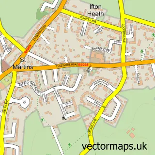
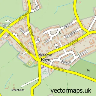
This St Martins street map is a detailed vector street map covering a 750m x 750m area. Select a larger area to create and download your own vector street map of St Martins.
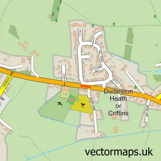
The 750-metre map sample for St Martins covers 296 mapped buildings and approximately 12.4 km of road detail, of which 15 named roads are named. The immediate area includes 1 pub and 1 MOT station, with 5 within 2 miles. The wider area around St Martins features 2 food and drink venues. To create a larger or custom map of St Martins, the map builder lets you define your own coverage area and download editable SVG, PDF and PNG files.
Create a larger editable map of St Martins
Choose any area you need and generate a high-quality vector map instantly. Perfect for print, planning, design, business and personal use.

This St Martins street map in Shropshire is available as downloadable SVG, PDF and PNG map files, or as a printed map for planning, business, display, education, local information and design work. You can also create a larger custom map area using the map selector.
What this St Martins map sample shows
St Martins lies within St. Martin's Cp parish, part of St Martin's ward in the Shropshire local authority area. The postcode geography for this area includes the SY postcode area, the SY11 postcode district and the SY11 3 postcode sector. Residents fall under the Nhs Shropshire, Telford And Wrekin Integrated Care Board for NHS services.
Local features near St Martins
Within 2 milesAmenities and services in and around St Martins.
Administrative and postcode information for St Martins
The local authority covering St Martins is Shropshire, within the county of Shropshire. The settlement lies within St Martin's ward and St. Martin's Cp civil parish. The SY11 postcode district and SY11 3 postcode sector serve the immediate area. NHS provision in the area is delivered through The Shrewsbury And Telford Hospital Nhs Trust.
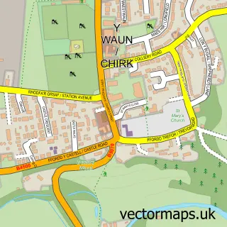
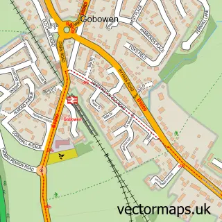
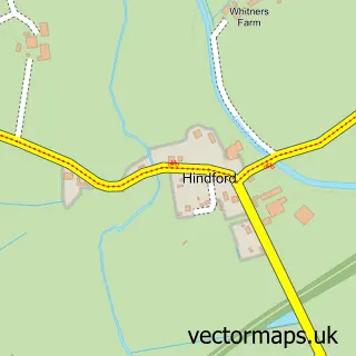
Nearby street map samples around St Martins

More street maps in Shropshire
750 metre map area coverage
Boundary, postcode and point of interest information for the 750m x 750m rectangle centred on this sample map.
Boundaries containing map centre
Constituency: North Shropshire Co Const
District: Shropshire
Icb: NHS Shropshire Telford and Wrekin ICB
Parish: St. Martin's CP
Police Force: west mercia
Postcode District: SY11
Postcode Sector: SY11 3
Nearby boundaries intersecting sample
Postcode District: SY10
Postcode Sector: SY10 7
Postcode coverage
POI category counts
Convenience Store: 2
Gas Station: 2
Anglican Church: 1
Charity Organization: 1
Christmas Trees: 1
Dog Walkers: 1
Fast Food Restaurant: 1
Fish And Chips Restaurant: 1
Package Locker: 1
Pet Groomer: 1
Sample points of interest
- St. Martins Parish Church
- Age UK St Martins Day Centre
- Canopy Tree Care
- Costcutter
- Londis
- GB Animal Services
- Aroma Spice
- Len's Plaice
- TEXACO Station
- Texaco
- InPost
- Shampooch Dog Grooming
Create a larger editable map of St Martins
This sample shows only a 750 metre area. To create a larger map of St Martins, use our map builder to choose your own coverage area, add titles and download editable SVG, PDF and PNG files.
Create a custom map of St Martins