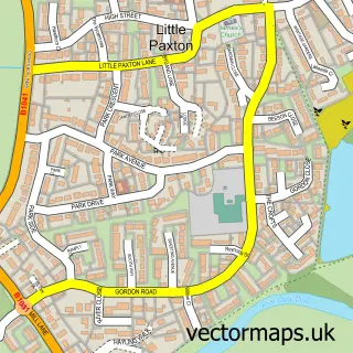
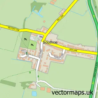
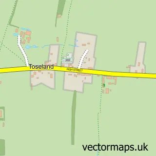
This St Neots street map is a detailed vector street map covering a 750m x 750m area. Select a larger area to create and download your own vector street map of St Neots.
The 750-metre map sample for St Neots covers 255 mapped buildings and approximately 14.6 km of road detail, of which 39 named roads are named. The immediate area includes 1 school, 2 GP surgeries, with 3 within 2 miles, 16 pubs and 1 MOT station, with 12 within 2 miles. The wider area around St Neots features 7 tourism points of interest, 41 food and drink venues and 1 hotel. To create a larger or custom map of St Neots, the map builder lets you define your own coverage area and download editable SVG, PDF and PNG files.
Create a larger editable map of St Neots
Choose any area you need and generate a high-quality vector map instantly. Perfect for print, planning, design, business and personal use.

This St Neots street map in Cambridgeshire is available as downloadable SVG, PDF and PNG map files, or as a printed map for planning, business, display, education, local information and design work. You can also create a larger custom map area using the map selector.
What this St Neots map sample shows
St Neots lies within St. Neots Cp parish, part of St Neots Eynesbury ward in the Huntingdonshire District local authority area. The postcode geography for this area includes the PE postcode area, the PE19 postcode district and the PE19 1 postcode sector. Residents fall under the Nhs Cambridgeshire And Peterborough Integrated Care Board for NHS services.
Local features near St Neots
Within 2 milesAmenities and services in and around St Neots.
Administrative and postcode information for St Neots
St Neots lies within St. Neots Cp parish, part of St Neots Eynesbury ward in the Huntingdonshire District local authority area. The postcode geography for this area includes the PE postcode area, the PE19 postcode district and the PE19 1 postcode sector. Residents fall under the Nhs Cambridgeshire And Peterborough Integrated Care Board for NHS services.
Nearby street map samples around St Neots

More street maps in Cambridgeshire
750 metre map area coverage
Boundary, postcode and point of interest information for the 750m x 750m rectangle centred on this sample map.
Boundaries containing map centre
Constituency: St. Neots and Mid Cambridgeshire Co Const
County: Cambridgeshire County
District: Huntingdonshire District
Icb: NHS Central East ICB
Parish: St. Neots CP
Police Force: cambridgeshire
Postcode District: PE19
Postcode Sector: PE19 2
Ward: St. Neots Eynesbury Ward
Nearby boundaries intersecting sample
Postcode Sector: PE19 1, PE19 7
Ward: St. Neots Eatons Ward, St. Neots Priory Park & Little Paxton Ward
Postcode coverage
POI category counts
Pub: 16
Beauty Salon: 14
Real Estate Agent: 14
Hair Salon: 12
Restaurant: 12
Dentist: 9
Professional Services: 9
Banks: 8
Barber: 8
Cafe: 8
Sample points of interest
- Accounting 4 Fitness
- Bradshaw Johnson
- Peter Chandler
- R S Partnership Accountants
- TaxAssist Accountants
- TaxAssist Accountants
- TaxAssist Accountants
- Pure Defiance
- Gillie Salter Acupuncture
- St Neots Chinese Medical Centre
- Kdm Communications
- Lilac James
Create a larger editable map of St Neots
This sample shows only a 750 metre area. To create a larger map of St Neots, use our map builder to choose your own coverage area, add titles and download editable SVG, PDF and PNG files.
Create a custom map of St Neots