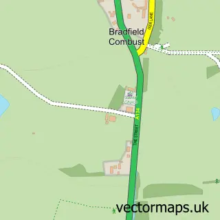
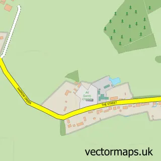
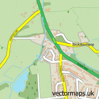
This Stanningfield street map is a detailed vector street map covering a 750m x 750m area. Select a larger area to create and download your own vector street map of Stanningfield.
The 750-metre map sample for Stanningfield covers 116 mapped buildings and approximately 6.4 km of road detail, of which 8 named roads are named. The immediate area includes 1 pub and 1 MOT station within 2 miles. The wider area around Stanningfield features 1 food and drink venue. To create a larger or custom map of Stanningfield, the map builder lets you define your own coverage area and download editable SVG, PDF and PNG files.
Create a larger editable map of Stanningfield
Choose any area you need and generate a high-quality vector map instantly. Perfect for print, planning, design, business and personal use.

This Stanningfield street map in Suffolk is available as downloadable SVG, PDF and PNG map files, or as a printed map for planning, business, display, education, local information and design work. You can also create a larger custom map area using the map selector.
What this Stanningfield map sample shows
Stanningfield lies within Bradfield Combust With Stanningfield Cp parish, part of Rougham ward in the West Suffolk District local authority area. The postcode geography for this area includes the IP postcode area, the IP29 postcode district and the IP29 4 postcode sector. Residents fall under the Nhs Suffolk And North East Essex Integrated Care Board for NHS services.
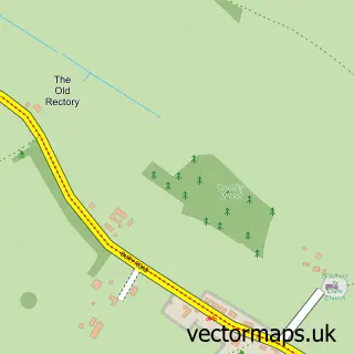
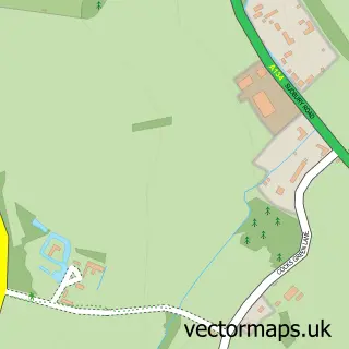
Local features near Stanningfield
Within 2 milesAmenities and services in and around Stanningfield.
Administrative and postcode information for Stanningfield
The local authority covering Stanningfield is West Suffolk District, within the county of Suffolk. The settlement lies within Rougham ward and Bradfield Combust With Stanningfield Cp civil parish. The IP29 postcode district and IP29 4 postcode sector serve the immediate area. NHS provision in the area is delivered through West Suffolk Nhs Foundation Trust.
Nearby street map samples around Stanningfield
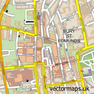

More street maps in Suffolk
750 metre map area coverage
Boundary, postcode and point of interest information for the 750m x 750m rectangle centred on this sample map.
Boundaries containing map centre
Constituency: Bury St. Edmunds and Stowmarket Co Const
County: Suffolk County
District: West Suffolk District
Icb: NHS Essex ICB
Parish: Bradfield Combust with Stanningfield CP
Police Force: suffolk
Postcode District: IP29
Postcode Sector: IP29 4
Ward: Rougham Ward
Nearby boundaries intersecting sample
Postcode District: IP30
Postcode Sector: IP30 0
Postcode coverage
POI category counts
Dog Walkers: 1
Event Technology Service: 1
Furniture Store: 1
Industrial Equipment: 1
Pet Groomer: 1
Pub: 1
Taxi Service: 1
Sample points of interest
- We Love Pets
- Gold 2 Glitter 70's Disco
- Saxon Floors
- Firstgrade Recycling Systems Ltd.
- Vanity Fur Dog Grooming
- The Red House
- Select Executive Cars
Create a larger editable map of Stanningfield
This sample shows only a 750 metre area. To create a larger map of Stanningfield, use our map builder to choose your own coverage area, add titles and download editable SVG, PDF and PNG files.
Create a custom map of Stanningfield