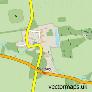
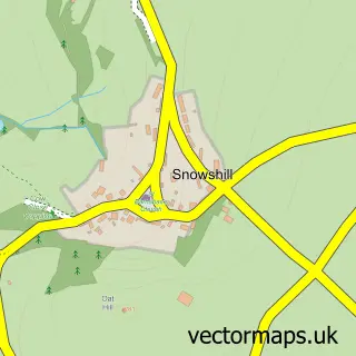
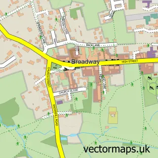
This Stanton street map is a detailed vector street map covering a 750m x 750m area. Select a larger area to create and download your own vector street map of Stanton.
The 750-metre map sample for Stanton covers 107 mapped buildings and approximately 9.4 km of road detail, of which 3 named roads are named. The immediate area includes 2 pubs. The wider area around Stanton features 2 food and drink venues and 5 hotels. To create a larger or custom map of Stanton, the map builder lets you define your own coverage area and download editable SVG, PDF and PNG files.
Create a larger editable map of Stanton
Choose any area you need and generate a high-quality vector map instantly. Perfect for print, planning, design, business and personal use.

This Stanton street map in Gloucestershire is available as downloadable SVG, PDF and PNG map files, or as a printed map for planning, business, display, education, local information and design work. You can also create a larger custom map area using the map selector.
What this Stanton map sample shows
Stanton lies within Stanton Cp parish, part of Isbourne ward in the Tewkesbury District (B) local authority area. The postcode geography for this area includes the WR postcode area, the WR12 postcode district and the WR12 7 postcode sector. Residents fall under the Nhs Gloucestershire Integrated Care Board for NHS services.
Local features near Stanton
Within 2 milesAmenities and services in and around Stanton.
Administrative and postcode information for Stanton
The local authority covering Stanton is Tewkesbury District (B), within the county of Gloucestershire. The settlement lies within Isbourne ward and Stanton Cp civil parish. The WR12 postcode district and WR12 7 postcode sector serve the immediate area. NHS provision in the area is delivered through Gloucestershire Hospitals Nhs Foundation Trust.
Nearby street map samples around Stanton

More street maps in Gloucestershire
750 metre map area coverage
Boundary, postcode and point of interest information for the 750m x 750m rectangle centred on this sample map.
Boundaries containing map centre
Constituency: Tewkesbury Co Const
County: Gloucestershire County
District: Tewkesbury District (B)
Icb: NHS Gloucestershire ICB
Parish: Stanton CP
Police Force: gloucestershire
Postcode District: WR12
Postcode Sector: WR12 7
Ward: Isbourne Ward
Nearby boundaries intersecting sample
No additional intersecting boundaries found.
Postcode coverage
POI category counts
Hotel: 5
Bed And Breakfast: 2
Pub: 2
Alternative Medicine: 1
Anglican Church: 1
Art Gallery: 1
Beauty Salon: 1
Business Consulting: 1
Contractor: 1
Cottage: 1
Sample points of interest
- Vine Herbal Products
- St Michael & All Angels
- Guild House Arts & Crafts Courses
- Haitches
- The Old Post House
- The Vine Bed and Breakfast
- Projectia
- Carenza Development
- Shenberrow B&B
- The Stanton Guild House
- The Broadway Florist
- Andrew Bird Hearing
Create a larger editable map of Stanton
This sample shows only a 750 metre area. To create a larger map of Stanton, use our map builder to choose your own coverage area, add titles and download editable SVG, PDF and PNG files.
Create a custom map of Stanton