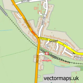
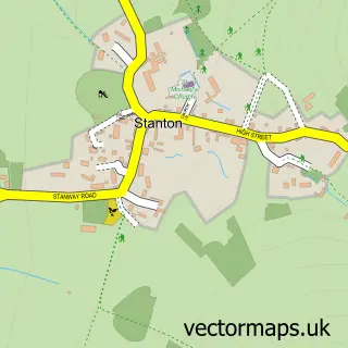
This Toddington street map is a detailed vector street map covering a 750m x 750m area. Select a larger area to create and download your own vector street map of Toddington.
The 750-metre map sample for Toddington covers 92 mapped buildings and approximately 11.1 km of road detail, of which 4 named roads are named. The immediate area includes 1 MOT station within 2 miles. The wider area around Toddington features 1 tourism point of interest and 2 campsites within 2 miles. To create a larger or custom map of Toddington, the map builder lets you define your own coverage area and download editable SVG, PDF and PNG files.
Create a larger editable map of Toddington
Choose any area you need and generate a high-quality vector map instantly. Perfect for print, planning, design, business and personal use.

This Toddington street map in Gloucestershire is available as downloadable SVG, PDF and PNG map files, or as a printed map for planning, business, display, education, local information and design work. You can also create a larger custom map area using the map selector.
What this Toddington map sample shows
Toddington lies within Toddington Cp parish, part of Isbourne ward in the Tewkesbury District (B) local authority area. The postcode geography for this area includes the GL postcode area, the GL54 postcode district and the GL54 5 postcode sector. Residents fall under the Nhs Gloucestershire Integrated Care Board for NHS services.
Local features near Toddington
Within 2 milesAmenities and services in and around Toddington.
Administrative and postcode information for Toddington
Toddington lies within Toddington Cp parish, part of Isbourne ward in the Tewkesbury District (B) local authority area. The postcode geography for this area includes the GL postcode area, the GL54 postcode district and the GL54 5 postcode sector. Residents fall under the Nhs Gloucestershire Integrated Care Board for NHS services.
Nearby street map samples around Toddington

More street maps in Gloucestershire
750 metre map area coverage
Boundary, postcode and point of interest information for the 750m x 750m rectangle centred on this sample map.
Boundaries containing map centre
Constituency: Tewkesbury Co Const
County: Gloucestershire County
District: Tewkesbury District (B)
Icb: NHS Gloucestershire ICB
Parish: Toddington CP
Police Force: gloucestershire
Postcode District: GL54
Postcode Sector: GL54 5
Ward: Isbourne Ward
Nearby boundaries intersecting sample
No additional intersecting boundaries found.
Postcode coverage
POI category counts
Caterer: 1
Church Cathedral: 1
Convenience Store: 1
Employment Agencies: 1
Printing Services: 1
Professional Services: 1
School: 1
Tours: 1
Tree Services: 1
Sample points of interest
- Toddington Village Hall
- St Andrew's Church
- Budgens Toddington
- The Association of Theraputic Communities
- The Mulberry Bush Third Space
- Planned Environment Therapy Trust
- Toddington Nursery School
- The Wayfarers
- Hares Tree and Garden Services
Create a larger editable map of Toddington
This sample shows only a 750 metre area. To create a larger map of Toddington, use our map builder to choose your own coverage area, add titles and download editable SVG, PDF and PNG files.
Create a custom map of Toddington