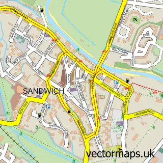
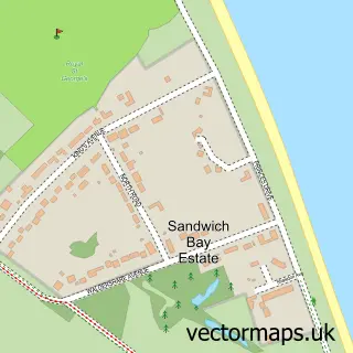
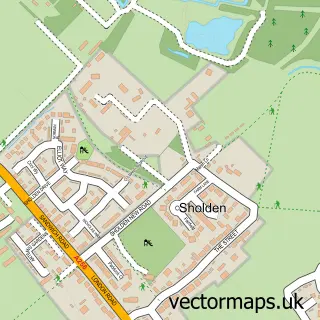
This Stone Cross street map is a detailed vector street map covering a 750m x 750m area. Select a larger area to create and download your own vector street map of Stone Cross.
The 750-metre map sample for Stone Cross covers 194 mapped buildings and approximately 6.4 km of road detail, of which 7 named roads are named. The immediate area includes 1 primary school and 1 secondary school, 1 GP surgery within 2 miles and 7 MOT stations within 2 miles. The wider area around Stone Cross features 1 tourism point of interest and 2 campsites within 2 miles. To create a larger or custom map of Stone Cross, the map builder lets you define your own coverage area and download editable SVG, PDF and PNG files.
Create a larger editable map of Stone Cross
Choose any area you need and generate a high-quality vector map instantly. Perfect for print, planning, design, business and personal use.

This Stone Cross street map in Kent is available as downloadable SVG, PDF and PNG map files, or as a printed map for planning, business, display, education, local information and design work. You can also create a larger custom map area using the map selector.
What this Stone Cross map sample shows
Stone Cross lies within Sandwich Cp parish, part of Sandwich ward in the Dover District local authority area. The postcode geography for this area includes the CT postcode area, the CT13 postcode district and the CT13 9 postcode sector. Residents fall under the Nhs Kent And Medway Integrated Care Board for NHS services.
Local features near Stone Cross
Within 2 milesAmenities and services in and around Stone Cross.
Administrative and postcode information for Stone Cross
The local authority covering Stone Cross is Dover District, within the county of Kent. The settlement lies within Sandwich ward and Sandwich Cp civil parish. The CT13 postcode district and CT13 9 postcode sector serve the immediate area. NHS provision in the area is delivered through East Kent Hospitals University Nhs Foundation Trust.
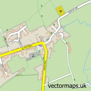
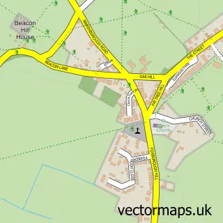
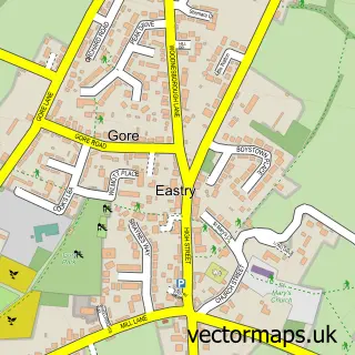
Nearby street map samples around Stone Cross

More street maps in Kent
750 metre map area coverage
Boundary, postcode and point of interest information for the 750m x 750m rectangle centred on this sample map.
Boundaries containing map centre
Constituency: Herne Bay and Sandwich Co Const
County: Kent County
District: Dover District
Icb: NHS Kent and Medway ICB
Parish: Sandwich CP
Police Force: kent
Postcode District: CT13
Postcode Sector: CT13 0
Ward: Sandwich Ward
Nearby boundaries intersecting sample
Constituency: Dover and Deal Co Const
Parish: Worth CP
Postcode District: CT14
Postcode Sector: CT13 9, CT14 0
Ward: Eastry Rural Ward
Postcode coverage
POI category counts
Assisted Living Facility: 1
Auto Glass Service: 1
Automotive Repair: 1
Campground: 1
Christmas Trees: 1
Electrician: 1
Elementary School: 1
Farmers Market: 1
Glass And Mirror Sales Service: 1
Gym: 1
Sample points of interest
- Hazelwood Meadow
- Allscreens Ltd.
- Allscreens Ltd
- Delf Caravan And Motorhome Cl
- Delf Farmshop & Nursery Ltd.
- P J Smith
- Sandwich Junior School
- Delf Farmshop & Nursery
- A J Windows and Doors
- Sandwich Leisure Centre
- Spring Childcare
- Chris Davison
Create a larger editable map of Stone Cross
This sample shows only a 750 metre area. To create a larger map of Stone Cross, use our map builder to choose your own coverage area, add titles and download editable SVG, PDF and PNG files.
Create a custom map of Stone Cross