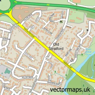
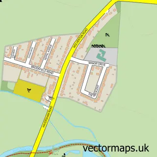
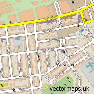
This Stony Stratford street map is a detailed vector street map covering a 750m x 750m area. Select a larger area to create and download your own vector street map of Stony Stratford.
The 750-metre map sample for Stony Stratford covers 374 mapped buildings and approximately 29.5 km of road detail, of which 37 named roads are named. The immediate area includes 2 schools, 2 GP surgeries, with 3 within 2 miles, 10 pubs and 2 MOT stations, with 18 within 2 miles. The wider area around Stony Stratford features 3 tourism points of interest, 27 food and drink venues and 3 hotels. To create a larger or custom map of Stony Stratford, the map builder lets you define your own coverage area and download editable SVG, PDF and PNG files.
Create a larger editable map of Stony Stratford
Choose any area you need and generate a high-quality vector map instantly. Perfect for print, planning, design, business and personal use.

This Stony Stratford street map in Buckinghamshire is available as downloadable SVG, PDF and PNG map files, or as a printed map for planning, business, display, education, local information and design work. You can also create a larger custom map area using the map selector.
What this Stony Stratford map sample shows
Stony Stratford lies within Stony Stratford Cp parish, part of Stony Stratford ward in the Milton Keynes (B) local authority area. The postcode geography for this area includes the MK postcode area, the MK11 postcode district and the MK11 1 postcode sector. Residents fall under the Nhs Bedfordshire, Luton And Milton Keynes Integrated Care Board for NHS services.
Local features near Stony Stratford
Within 2 milesAmenities and services in and around Stony Stratford.
Administrative and postcode information for Stony Stratford
The local authority covering Stony Stratford is Milton Keynes (B), within the county of Buckinghamshire. The settlement lies within Stony Stratford ward and Stony Stratford Cp civil parish. The MK11 postcode district and MK11 1 postcode sector serve the immediate area. NHS provision in the area is delivered through Milton Keynes University Hospital Nhs Foundation Trust.
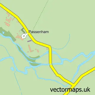
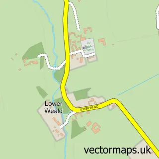
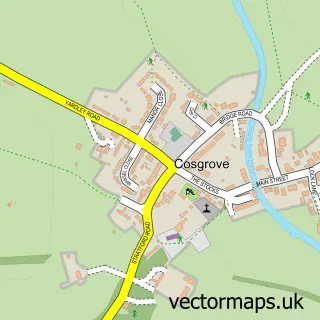
Nearby street map samples around Stony Stratford


More street maps in Buckinghamshire
750 metre map area coverage
Boundary, postcode and point of interest information for the 750m x 750m rectangle centred on this sample map.
Boundaries containing map centre
Constituency: Milton Keynes North Co Const
District: Milton Keynes (B)
Icb: NHS Central East ICB
Parish: Stony Stratford CP
Police Force: thames valley
Postcode District: MK11
Postcode Sector: MK11 1
Ward: Stony Stratford Ward
Nearby boundaries intersecting sample
Constituency: South Northamptonshire Co Const
District: West Northamptonshire
Police Force: northamptonshire
Postcode District: MK19
Postcode Sector: MK19 6
Ward: Deanshanger & Paulerspury Ward
Postcode coverage
POI category counts
Beauty Salon: 15
Hair Salon: 12
Real Estate Agent: 11
Financial Service: 10
Pub: 10
Flowers And Gifts Shop: 9
Indian Restaurant: 9
Advertising Agency: 8
Cafe: 8
Barber: 7
Sample points of interest
- Connolly Accountants
- Connolly Holmes Accounts LLP
- Evolve Accounting Solutions
- Hickeson Boyce Chartered Certified Accountants
- Rapture Accounts Limited
- We Balance Bookkeeping
- MK City Kyokushin Karate
- Five Spirits Acupuncture
- Lightworker Therapies
- Stony Acupuncture
- 7D Media
- Bitmedia.IO
Create a larger editable map of Stony Stratford
This sample shows only a 750 metre area. To create a larger map of Stony Stratford, use our map builder to choose your own coverage area, add titles and download editable SVG, PDF and PNG files.
Create a custom map of Stony Stratford