Vector Maps logo
Home Why it works Popular maps Districts Samples Customizer Create Your Map
VectorMaps.uk
Home Popular maps Districts Samples Customizer Create Your Map Privacy Disclaimer
Home / UK Maps / Northamptonshire / Potterspury Map

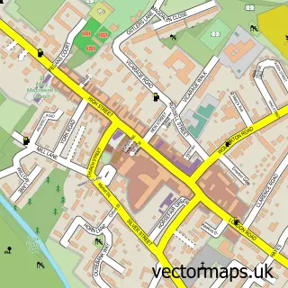
This Potterspury street map is a detailed vector street map covering a 750m x 750m area. Select a larger area to create and download your own vector street map of Potterspury.

Potterspury is a village in Northamptonshire, in the East Midlands of England. The settlement falls within the South Northamptonshire parliamentary constituency. It is served by the NN12 postcode district, with NN12 6 as the local postcode sector.

The 750-metre map sample for Potterspury covers 363 mapped buildings and approximately 22.4 km of road detail, of which 17 named roads are named. The immediate area includes 1 school, 1 pub and 4 MOT stations within 2 miles. The wider area around Potterspury features 1 food and drink venue. To create a larger or custom map of Potterspury, the map builder lets you define your own coverage area and download editable SVG, PDF and PNG files.

363Buildings
22.42 kmRoads
17Named roads
2,963Residents within 2 miles
Create your own

Create a larger editable map of Potterspury

Choose any area you need and generate a high-quality vector map instantly. Perfect for print, planning, design, business and personal use.

Choose any location
Editable SVG files
Any size up to A0
PDF, PNG & more
Instant download
High quality guaranteed
Create My Custom Map
Secure, private & no credit card required
Potterspury Vector Street Map
750m Sample
Potterspury vector street map sample showing roads, buildings and local features in a 750 metre preview area
Buy Potterspury Map Print from £12.95 Buy Potterspury Digital Map from £6

This Potterspury street map in Northamptonshire is available as downloadable SVG, PDF and PNG map files, or as a printed map for planning, business, display, education, local information and design work. You can also create a larger custom map area using the map selector.

What this Potterspury map sample shows

Potterspury lies within Potterspury Cp parish, part of Whittlewood ward in the West Northamptonshire local authority area. The postcode geography for this area includes the NN postcode area, the NN12 postcode district and the NN12 6 postcode sector. Residents fall under the Nhs Northamptonshire Integrated Care Board for NHS services.

Local features near Potterspury

Within 2 miles

Amenities and services in and around Potterspury.

1 Schools
4 MOT stations within 2 miles
1 Food & drink
1 Pubs
1 Vehicle services

Counts are approximate and based on publicly available data.

Administrative and postcode information for Potterspury

Potterspury lies within Potterspury Cp parish, part of Whittlewood ward in the West Northamptonshire local authority area. The postcode geography for this area includes the NN postcode area, the NN12 postcode district and the NN12 6 postcode sector. Residents fall under the Nhs Northamptonshire Integrated Care Board for NHS services.

Parish Potterspury CP
Ward Whittlewood
District / local authority West Northamptonshire
County Northamptonshire
Historic county Northamptonshire
Postcode district NN12
Postcode sector NN12 6
Parliamentary constituency South Northamptonshire
Region East Midlands
Country England

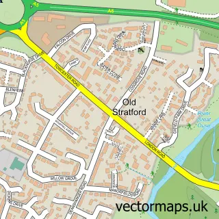
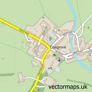
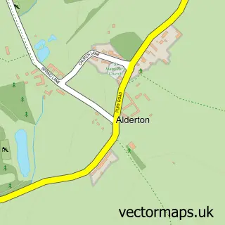
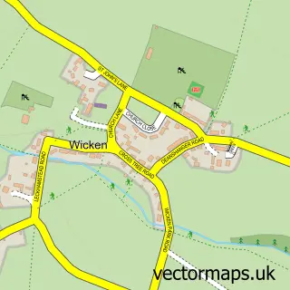
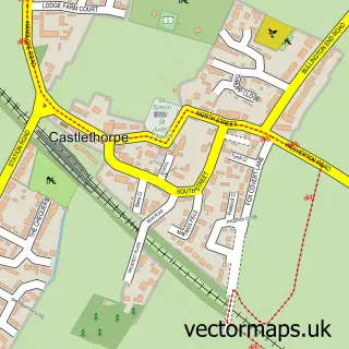
Nearby street map samples around Potterspury

Street map sample of Stony Stratford, Buckinghamshire Stony Stratford Town - Buckinghamshire - 2.5 miles Street map sample of Milton Keynes, Buckinghamshire Milton Keynes City - Buckinghamshire - 6.4 miles Street map sample of Yardley Gobion, Northamptonshire Yardley Gobion Village - Northamptonshire - 1.0 miles Street map sample of Old Stratford, Northamptonshire Old Stratford Village - Northamptonshire - 1.8 miles Street map sample of Cosgrove, Northamptonshire Cosgrove Village - Northamptonshire - 2.1 miles Street map sample of Deanshanger, Northamptonshire Deanshanger Village - Northamptonshire - 2.1 miles Street map sample of Alderton, Northamptonshire Alderton Village - Northamptonshire - 2.4 miles Street map sample of Wicken, Northamptonshire Wicken Village - Northamptonshire - 2.5 miles Street map sample of Castlethorpe, Buckinghamshire Castlethorpe Village - Buckinghamshire - 2.7 miles Street map sample of Paulerspury, Northamptonshire Paulerspury Village - Northamptonshire - 2.8 miles

More street maps in Northamptonshire

Street map sample of Yardley Gobion, Northamptonshire Yardley Gobion Village - 1.0 miles Street map sample of Old Stratford, Northamptonshire Old Stratford Village - 1.8 miles Street map sample of Cosgrove, Northamptonshire Cosgrove Village - 2.1 miles Street map sample of Deanshanger, Northamptonshire Deanshanger Village - 2.1 miles Street map sample of Alderton, Northamptonshire Alderton Village - 2.4 miles

750 metre map area coverage

Boundary, postcode and point of interest information for the 750m x 750m rectangle centred on this sample map.

Boundaries containing map centre

Constituency: South Northamptonshire Co Const

District: West Northamptonshire

Icb: NHS Northamptonshire ICB

Parish: Potterspury CP

Police Force: northamptonshire

Postcode District: NN12

Postcode Sector: NN12 7

Ward: Deanshanger & Paulerspury Ward

Nearby boundaries intersecting sample

Postcode Sector: NN12 6

Postcode coverage

NN12 NN12 7 NN12 6

POI category counts

Driving School: 2

Post Office: 2

Shipping Center: 2

Automotive Repair: 1

Beer Garden: 1

Building Supply Store: 1

Childrens Clothing Store: 1

Chimney Sweep: 1

Church Cathedral: 1

Corporate Entertainment Services: 1

Sample points of interest

  • Churchill Motors Automotive Repair
  • King George III Bar Beer Garden
  • KES Electrical Building Supply Store
  • Ooh Baby Baby Store Childrens Clothing Store
  • Bucks Chimney Sweeps Chimney Sweep
  • St Nicholas Church Church Cathedral
  • Jemlar Corporate Entertainment Services
  • Post Office Travel Money Currency Exchange
  • Casket of Curiosities Department Store
  • Creative Utilities Solutions Distribution Services
  • M K Driver Training Driving School
  • MK Driver Training Driving School

Create a larger editable map of Potterspury

This sample shows only a 750 metre area. To create a larger map of Potterspury, use our map builder to choose your own coverage area, add titles and download editable SVG, PDF and PNG files.

Create a custom map of Potterspury

Phone 01751 473136 | Copyright Vectormaps.uk 2026

Samples Customizer Privacy Disclaimer
Potterspury Vector Street Map
Potterspury enlarged street map sample showing a 750 metre preview area