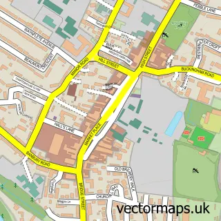
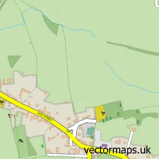
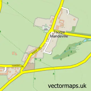
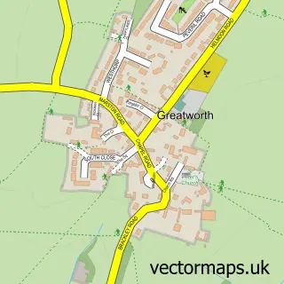
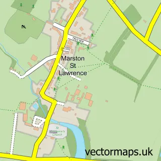
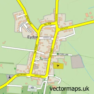
This Sulgrave street map is a detailed vector street map covering a 750m x 750m area. Select a larger area to create and download your own vector street map of Sulgrave.
The 750-metre map sample for Sulgrave covers 109 mapped buildings and approximately 14.0 km of road detail, of which 8 named roads are named. The immediate area includes 1 pub and 1 MOT station within 2 miles. The wider area around Sulgrave features 1 tourism point of interest and 1 food and drink venue. To create a larger or custom map of Sulgrave, the map builder lets you define your own coverage area and download editable SVG, PDF and PNG files.
Create a larger editable map of Sulgrave
Choose any area you need and generate a high-quality vector map instantly. Perfect for print, planning, design, business and personal use.

This Sulgrave street map in Northamptonshire is available as downloadable SVG, PDF and PNG map files, or as a printed map for planning, business, display, education, local information and design work. You can also create a larger custom map area using the map selector.
What this Sulgrave map sample shows
Sulgrave lies within Sulgrave Cp parish, part of Washington ward in the West Northamptonshire local authority area. The postcode geography for this area includes the OX postcode area, the OX17 postcode district and the OX17 2 postcode sector. Residents fall under the Nhs Northamptonshire Integrated Care Board for NHS services.
Local features near Sulgrave
Within 2 milesAmenities and services in and around Sulgrave.
Administrative and postcode information for Sulgrave
Sulgrave lies within Sulgrave Cp parish, part of Washington ward in the West Northamptonshire local authority area. The postcode geography for this area includes the OX postcode area, the OX17 postcode district and the OX17 2 postcode sector. Residents fall under the Nhs Northamptonshire Integrated Care Board for NHS services.
Nearby street map samples around Sulgrave

More street maps in Northamptonshire
750 metre map area coverage
Boundary, postcode and point of interest information for the 750m x 750m rectangle centred on this sample map.
Boundaries containing map centre
Constituency: South Northamptonshire Co Const
District: West Northamptonshire
Icb: NHS Northamptonshire ICB
Parish: Sulgrave CP
Police Force: northamptonshire
Postcode District: OX17
Postcode Sector: OX17 2
Ward: Rural South Northamptonshire Ward
Nearby boundaries intersecting sample
No additional intersecting boundaries found.
Postcode coverage
POI category counts
Shipping Center: 2
Anglican Church: 1
Business Management Services: 1
Castle: 1
Caterer: 1
Church Cathedral: 1
Convenience Store: 1
Farm: 1
Food Beverage Service Distribution: 1
Gym: 1
Sample points of interest
- St James the Less
- The Career Management Professional
- Sulgrave Castle Hill
- Websters Event Catering
- Church of St James the Less, Sulgrave
- Premier JJ Convenience Store
- Windmill Orchards
- Fabulous Afternoon Tea
- Sulgrave Village Hall
- Walking Pawz
- The Star Inn
- Post Office
Create a larger editable map of Sulgrave
This sample shows only a 750 metre area. To create a larger map of Sulgrave, use our map builder to choose your own coverage area, add titles and download editable SVG, PDF and PNG files.
Create a custom map of Sulgrave