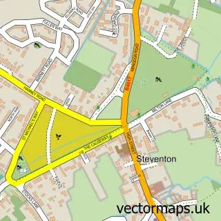
This Sutton Courtenay street map is a detailed vector street map covering a 750m x 750m area. Select a larger area to create and download your own vector street map of Sutton Courtenay.
The 750-metre map sample for Sutton Courtenay covers 251 mapped buildings and approximately 9.9 km of road detail, of which 15 named roads are named. The immediate area includes 1 MOT station, with 6 within 2 miles. The wider area around Sutton Courtenay features 2 tourism points of interest. To create a larger or custom map of Sutton Courtenay, the map builder lets you define your own coverage area and download editable SVG, PDF and PNG files.
Create a larger editable map of Sutton Courtenay
Choose any area you need and generate a high-quality vector map instantly. Perfect for print, planning, design, business and personal use.

This Sutton Courtenay street map in Oxfordshire is available as downloadable SVG, PDF and PNG map files, or as a printed map for planning, business, display, education, local information and design work. You can also create a larger custom map area using the map selector.
What this Sutton Courtenay map sample shows
Sutton Courtenay lies within Sutton Courtenay Cp parish, part of Sutton Courtenay ward in the Vale Of White Horse District local authority area. The postcode geography for this area includes the OX postcode area, the OX14 postcode district and the OX14 4 postcode sector. Residents fall under the Nhs Buckinghamshire, Oxfordshire And Berkshire West Integrated Care Board for NHS services.
Local features near Sutton Courtenay
Within 2 milesAmenities and services in and around Sutton Courtenay.
Administrative and postcode information for Sutton Courtenay
The local authority covering Sutton Courtenay is Vale Of White Horse District, within the county of Oxfordshire. The settlement lies within Sutton Courtenay ward and Sutton Courtenay Cp civil parish. The OX14 postcode district and OX14 4 postcode sector serve the immediate area. NHS provision in the area is delivered through Oxford University Hospitals Nhs Foundation Trust.
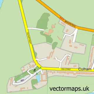
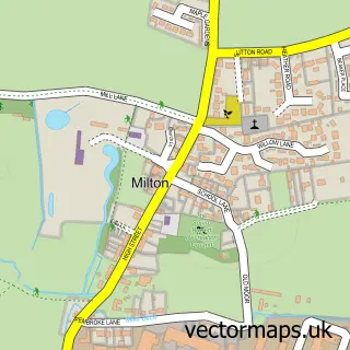
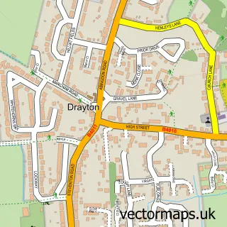
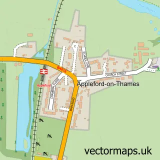
Nearby street map samples around Sutton Courtenay


More street maps in Oxfordshire
750 metre map area coverage
Boundary, postcode and point of interest information for the 750m x 750m rectangle centred on this sample map.
Boundaries containing map centre
Constituency: Didcot and Wantage Co Const
County: Oxfordshire County
District: Vale of White Horse District
Icb: NHS Thames Valley ICB
Parish: Sutton Courtenay CP
Police Force: thames valley
Postcode District: OX14
Postcode Sector: OX14 4
Ward: Sutton Courtenay Ward
Nearby boundaries intersecting sample
District: South Oxfordshire District
Parish: Culham CP
Ward: Sandford & the Wittenhams Ward
Postcode coverage
POI category counts
Automotive Repair: 2
Building Supply Store: 2
Architect: 1
Bar: 1
Carpenter: 1
Community Services Non Profits: 1
Elementary School: 1
Hardware Store: 1
Home Health Care: 1
Home Improvement Store: 1
Sample points of interest
- Graeme Jones
- Dragontek Automotive
- Savvi In Oxfordshire
- Swan Food House & Bar
- Brazilistone
- Northlight
- Leading Edge
- Matrix Arts Centre
- All Saints' Singers - Sutton Courtenay
- Thames Valley Stoves
- Home Helpers Care
- Brazili Stone
Create a larger editable map of Sutton Courtenay
This sample shows only a 750 metre area. To create a larger map of Sutton Courtenay, use our map builder to choose your own coverage area, add titles and download editable SVG, PDF and PNG files.
Create a custom map of Sutton Courtenay