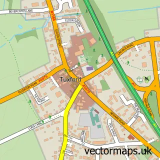
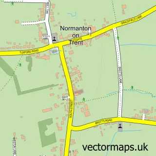
This Sutton on Trent street map is a detailed vector street map covering a 750m x 750m area. Select a larger area to create and download your own vector street map of Sutton on Trent.
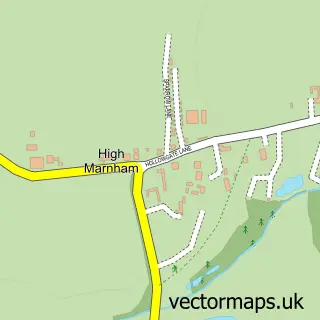
The 750-metre map sample for Sutton on Trent covers 272 mapped buildings and approximately 17.8 km of road detail, of which 18 named roads are named. The immediate area includes 1 school, 1 GP surgery within 2 miles, 1 pub and 1 MOT station within 2 miles. The wider area around Sutton on Trent features 1 food and drink venue. To create a larger or custom map of Sutton on Trent, the map builder lets you define your own coverage area and download editable SVG, PDF and PNG files.
Create a larger editable map of Sutton on Trent
Choose any area you need and generate a high-quality vector map instantly. Perfect for print, planning, design, business and personal use.

This Sutton on Trent street map in Nottinghamshire is available as downloadable SVG, PDF and PNG map files, or as a printed map for planning, business, display, education, local information and design work. You can also create a larger custom map area using the map selector.
What this Sutton on Trent map sample shows
Sutton on Trent lies within Sutton-On-Trent Cp parish, part of Sutton-On-Trent ward in the Newark And Sherwood District local authority area. The postcode geography for this area includes the NG postcode area, the NG23 postcode district and the NG23 6 postcode sector. Residents fall under the Nhs Nottingham And Nottinghamshire Integrated Care Board for NHS services.
Local features near Sutton on Trent
Within 2 milesAmenities and services in and around Sutton on Trent.
Administrative and postcode information for Sutton on Trent
Sutton on Trent lies within Sutton-On-Trent Cp parish, part of Sutton-On-Trent ward in the Newark And Sherwood District local authority area. The postcode geography for this area includes the NG postcode area, the NG23 postcode district and the NG23 6 postcode sector. Residents fall under the Nhs Nottingham And Nottinghamshire Integrated Care Board for NHS services.
Nearby street map samples around Sutton on Trent

More street maps in Nottinghamshire
750 metre map area coverage
Boundary, postcode and point of interest information for the 750m x 750m rectangle centred on this sample map.
Boundaries containing map centre
Constituency: Newark Co Const
County: Nottinghamshire County
District: Newark and Sherwood District
Icb: NHS Nottingham and Nottinghamshire ICB
Parish: Sutton-on-Trent CP
Police Force: nottinghamshire
Postcode District: NG23
Postcode Sector: NG23 6
Ward: Sutton-on-Trent Ward
Nearby boundaries intersecting sample
No additional intersecting boundaries found.
Postcode coverage
POI category counts
Beauty Salon: 2
Business Manufacturing And Supply: 2
Church Cathedral: 2
Anglican Church: 1
Auto Customization: 1
Beauty And Spa: 1
Business Consulting: 1
Contractor: 1
Delicatessen: 1
Elementary School: 1
Sample points of interest
- Sutton on Trent: All Saints
- Auto Interiors
- The Lash Lady
- Nails At No49
- The Box Sutton On Trent
- Sovereign Consultancy It
- Bingham Ground Services
- Soft Top Surfacing
- All Saints Church
- Sutton on Trent Methodist Church
- Tilbrook Interiors
- The Deli at No 4 Limited
Create a larger editable map of Sutton on Trent
This sample shows only a 750 metre area. To create a larger map of Sutton on Trent, use our map builder to choose your own coverage area, add titles and download editable SVG, PDF and PNG files.
Create a custom map of Sutton on Trent