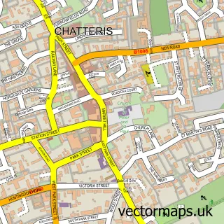
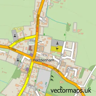
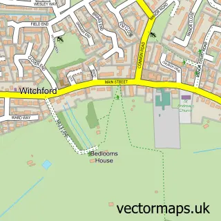
This Sutton street map is a detailed vector street map covering a 750m x 750m area. Select a larger area to create and download your own vector street map of Sutton.
The 750-metre map sample for Sutton covers 582 mapped buildings and approximately 14.4 km of road detail, of which 31 named roads are named. The immediate area includes 1 school, 1 GP surgery and 1 MOT station within 2 miles. The wider area around Sutton features 1 tourism point of interest and 3 food and drink venues. To create a larger or custom map of Sutton, the map builder lets you define your own coverage area and download editable SVG, PDF and PNG files.
Create a larger editable map of Sutton
Choose any area you need and generate a high-quality vector map instantly. Perfect for print, planning, design, business and personal use.

This Sutton street map in Cambridgeshire is available as downloadable SVG, PDF and PNG map files, or as a printed map for planning, business, display, education, local information and design work. You can also create a larger custom map area using the map selector.
What this Sutton map sample shows
Sutton lies within Sutton Cp parish, part of Sutton ward in the East Cambridgeshire District local authority area. The postcode geography for this area includes the CB postcode area, the CB6 postcode district and the CB6 2 postcode sector. Residents fall under the Nhs Cambridgeshire And Peterborough Integrated Care Board for NHS services.
Local features near Sutton
Within 2 milesAmenities and services in and around Sutton.
Administrative and postcode information for Sutton
The local authority covering Sutton is East Cambridgeshire District, within the county of Cambridgeshire. The settlement lies within Sutton ward and Sutton Cp civil parish. The CB6 postcode district and CB6 2 postcode sector serve the immediate area. NHS provision in the area is delivered through Cambridge University Hospitals Nhs Foundation Trust.
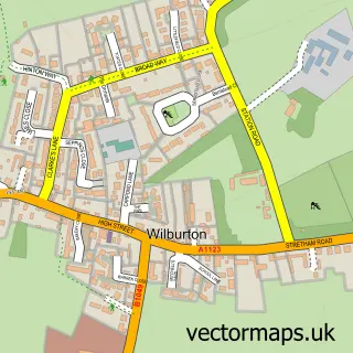
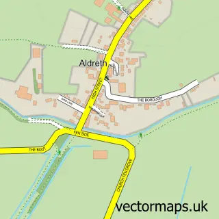
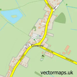
Nearby street map samples around Sutton

More street maps in Cambridgeshire
750 metre map area coverage
Boundary, postcode and point of interest information for the 750m x 750m rectangle centred on this sample map.
Boundaries containing map centre
Constituency: Ely and East Cambridgeshire Co Const
County: Cambridgeshire County
District: East Cambridgeshire District
Icb: NHS Central East ICB
Parish: Sutton CP
Police Force: cambridgeshire
Postcode District: CB6
Postcode Sector: CB6 2
Ward: Sutton Ward
Nearby boundaries intersecting sample
No additional intersecting boundaries found.
Postcode coverage
POI category counts
Indian Restaurant: 2
Restaurant: 2
Sports Club And League: 2
Accountant: 1
Auto Electrical Repair: 1
Automotive Repair: 1
Bar: 1
Barber: 1
Beauty And Spa: 1
Beauty Salon: 1
Sample points of interest
- Liberty Accountants & Bookkeeping Services
- Cool Breeze Mobile Car Aircon Regas Service
- A L Windscreens
- Iforce
- Olivers Barber Shop
- Sidneymiller
- ND Beauty
- Gary Rowsel Photography
- S & J Plastering
- Sutton Deli at 65
- Home Start
- The Royal British Legion
Create a larger editable map of Sutton
This sample shows only a 750 metre area. To create a larger map of Sutton, use our map builder to choose your own coverage area, add titles and download editable SVG, PDF and PNG files.
Create a custom map of Sutton