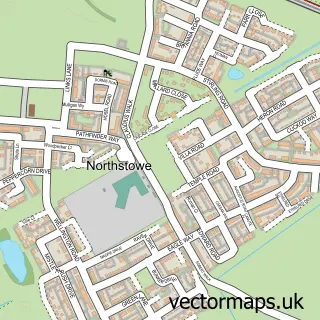
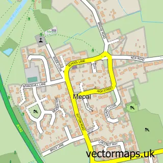
This Haddenham street map is a detailed vector street map covering a 750m x 750m area. Select a larger area to create and download your own vector street map of Haddenham.
The 750-metre map sample for Haddenham covers 285 mapped buildings and approximately 7.0 km of road detail, of which 17 named roads are named. The immediate area includes 1 school, 1 GP surgery, 1 pub and 1 MOT station, with 2 within 2 miles. The wider area around Haddenham features 1 tourism point of interest and 1 food and drink venue. To create a larger or custom map of Haddenham, the map builder lets you define your own coverage area and download editable SVG, PDF and PNG files.
Create a larger editable map of Haddenham
Choose any area you need and generate a high-quality vector map instantly. Perfect for print, planning, design, business and personal use.

This Haddenham street map in Cambridgeshire is available as downloadable SVG, PDF and PNG map files, or as a printed map for planning, business, display, education, local information and design work. You can also create a larger custom map area using the map selector.
What this Haddenham map sample shows
Haddenham lies within Haddenham Cp parish, part of Haddenham ward in the East Cambridgeshire District local authority area. The postcode geography for this area includes the CB postcode area, the CB6 postcode district and the CB6 3 postcode sector. Residents fall under the Nhs Cambridgeshire And Peterborough Integrated Care Board for NHS services.
Local features near Haddenham
Within 2 milesAmenities and services in and around Haddenham.
Administrative and postcode information for Haddenham
The local authority covering Haddenham is East Cambridgeshire District, within the county of Cambridgeshire. The settlement lies within Haddenham ward and Haddenham Cp civil parish. The CB6 postcode district and CB6 3 postcode sector serve the immediate area. NHS provision in the area is delivered through Cambridge University Hospitals Nhs Foundation Trust.
Nearby street map samples around Haddenham

More street maps in Cambridgeshire
750 metre map area coverage
Boundary, postcode and point of interest information for the 750m x 750m rectangle centred on this sample map.
Boundaries containing map centre
Constituency: Ely and East Cambridgeshire Co Const
County: Cambridgeshire County
District: East Cambridgeshire District
Icb: NHS Central East ICB
Parish: Haddenham CP
Police Force: cambridgeshire
Postcode District: CB6
Postcode Sector: CB6 3
Ward: Haddenham Ward
Nearby boundaries intersecting sample
No additional intersecting boundaries found.
Postcode coverage
POI category counts
Arts And Crafts: 3
Anglican Church: 2
Automotive Repair: 2
Building Supply Store: 2
Convenience Store: 2
Doctor: 2
Educational Services: 2
Fast Food Restaurant: 2
Florist: 2
Home Service: 2
Sample points of interest
- Krome Advertising
- Holy Trinity Church
- Holy Trinity Church Haddenham Cambridgeshire
- RBF Festivals
- Sally Wigglesworth
- Spoilt Rotten Beads
- The Corner Studio
- The Creative Craftorium
- Haddenham Arts Centre
- BR Spar Haddenham, Haddenham
- H R M Motor Cars
- HRM Motorcars
Create a larger editable map of Haddenham
This sample shows only a 750 metre area. To create a larger map of Haddenham, use our map builder to choose your own coverage area, add titles and download editable SVG, PDF and PNG files.
Create a custom map of Haddenham