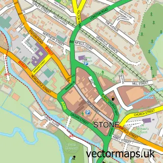
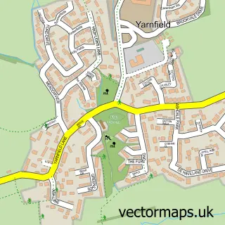
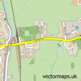
This Swynnerton street map is a detailed vector street map covering a 750m x 750m area. Select a larger area to create and download your own vector street map of Swynnerton.
The 750-metre map sample for Swynnerton covers 166 mapped buildings and approximately 12.8 km of road detail, of which 15 named roads are named. The immediate area includes 1 pub and 1 MOT station, with 3 within 2 miles. The wider area around Swynnerton features 1 food and drink venue. To create a larger or custom map of Swynnerton, the map builder lets you define your own coverage area and download editable SVG, PDF and PNG files.
Create a larger editable map of Swynnerton
Choose any area you need and generate a high-quality vector map instantly. Perfect for print, planning, design, business and personal use.

This Swynnerton street map in Staffordshire is available as downloadable SVG, PDF and PNG map files, or as a printed map for planning, business, display, education, local information and design work. You can also create a larger custom map area using the map selector.
What this Swynnerton map sample shows
Swynnerton lies within Swynnerton Cp parish, part of Swynnerton & Oulton ward in the Stafford District (B) local authority area. The postcode geography for this area includes the ST postcode area, the ST15 postcode district and the ST15 0 postcode sector. Residents fall under the Nhs Staffordshire And Stoke-On-Trent Integrated Care Board for NHS services.
Local features near Swynnerton
Within 2 milesAmenities and services in and around Swynnerton.
Administrative and postcode information for Swynnerton
The local authority covering Swynnerton is Stafford District (B), within the county of Staffordshire. The settlement lies within Swynnerton & Oulton ward and Swynnerton Cp civil parish. The ST15 postcode district and ST15 0 postcode sector serve the immediate area. NHS provision in the area is delivered through University Hospitals Of North Midlands Nhs Trust.
Nearby street map samples around Swynnerton

More street maps in Staffordshire
750 metre map area coverage
Boundary, postcode and point of interest information for the 750m x 750m rectangle centred on this sample map.
Boundaries containing map centre
Constituency: Stoke-on-Trent South Co Const
County: Staffordshire County
District: Stafford District (B)
Icb: NHS Staffordshire and Stoke-on-Trent ICB
Parish: Swynnerton CP
Police Force: staffordshire
Postcode District: ST15
Postcode Sector: ST15 0
Ward: Swynnerton & Oulton Ward
Nearby boundaries intersecting sample
No additional intersecting boundaries found.
Postcode coverage
POI category counts
Gardener: 2
Anglican Church: 1
Church Cathedral: 1
Cinema: 1
Community Center: 1
Community Services Non Profits: 1
Contractor: 1
Equestrian Facility: 1
Forestry Service: 1
Graphic Designer: 1
Sample points of interest
- St. Mary's, Swynnerton
- St Mary's Swynnerton
- Vue Cinema Newcastle
- Swynnerton Village Hall
- Swynnerton Hall
- MD Compliance Services
- Equine Therapy Solutions UK
- Lord Stafford Estates
- AER Garden Services Ltd
- Dave's Gardening Services
- Creative Cottage
- Matthew Uffindell Photography
Create a larger editable map of Swynnerton
This sample shows only a 750 metre area. To create a larger map of Swynnerton, use our map builder to choose your own coverage area, add titles and download editable SVG, PDF and PNG files.
Create a custom map of Swynnerton