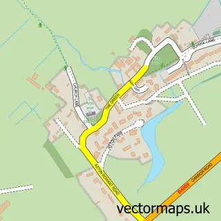
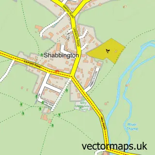
This Tetsworth street map is a detailed vector street map covering a 750m x 750m area. Select a larger area to create and download your own vector street map of Tetsworth.
The 750-metre map sample for Tetsworth covers 262 mapped buildings and approximately 16.7 km of road detail, of which 16 named roads are named. The immediate area includes 1 school and 1 pub. The wider area around Tetsworth features 1 food and drink venue and 1 campsite within 2 miles. To create a larger or custom map of Tetsworth, the map builder lets you define your own coverage area and download editable SVG, PDF and PNG files.
Create a larger editable map of Tetsworth
Choose any area you need and generate a high-quality vector map instantly. Perfect for print, planning, design, business and personal use.

This Tetsworth street map in Oxfordshire is available as downloadable SVG, PDF and PNG map files, or as a printed map for planning, business, display, education, local information and design work. You can also create a larger custom map area using the map selector.
What this Tetsworth map sample shows
Tetsworth lies within Tetsworth Cp parish, part of Haseley Brook ward in the South Oxfordshire District local authority area. The postcode geography for this area includes the OX postcode area, the OX9 postcode district and the OX9 7 postcode sector. Residents fall under the Nhs Buckinghamshire, Oxfordshire And Berkshire West Integrated Care Board for NHS services.
Local features near Tetsworth
Within 2 milesAmenities and services in and around Tetsworth.
Administrative and postcode information for Tetsworth
The local authority covering Tetsworth is South Oxfordshire District, within the county of Oxfordshire. The settlement lies within Haseley Brook ward and Tetsworth Cp civil parish. The OX9 postcode district and OX9 7 postcode sector serve the immediate area. NHS provision in the area is delivered through Buckinghamshire Healthcare Nhs Trust.
Nearby street map samples around Tetsworth

More street maps in Oxfordshire
750 metre map area coverage
Boundary, postcode and point of interest information for the 750m x 750m rectangle centred on this sample map.
Boundaries containing map centre
Constituency: Henley and Thame Co Const
County: Oxfordshire County
District: South Oxfordshire District
Icb: NHS Thames Valley ICB
Parish: Tetsworth CP
Police Force: thames valley
Postcode District: OX9
Postcode Sector: OX9 7
Ward: Haseley Brook Ward
Nearby boundaries intersecting sample
No additional intersecting boundaries found.
Postcode coverage
POI category counts
Elementary School: 2
Anglican Church: 1
Antique Store: 1
Automotive: 1
Bakery: 1
Business Office Supplies And Stationery: 1
Caterer: 1
Church Cathedral: 1
Community Center: 1
Convenience Store: 1
Sample points of interest
- Tetsworth St Giles
- The Swan At Tetsworth Antiques Centre
- RS Cars of Thame
- Wealden House Kitchen
- Fine & Dandy
- Jc's Pop Up Bar
- St Giles Church
- Tetsworth Memorial Hall
- Post Office-Tetsworth Mobile Service
- Hair by MissTresses
- Tetsworth Primary School
- Tetsworth Primary School Association
Create a larger editable map of Tetsworth
This sample shows only a 750 metre area. To create a larger map of Tetsworth, use our map builder to choose your own coverage area, add titles and download editable SVG, PDF and PNG files.
Create a custom map of Tetsworth