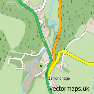
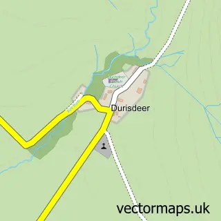
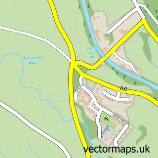
This Thornhill street map is a detailed vector street map covering a 750m x 750m area. Select a larger area to create and download your own vector street map of Thornhill.
The 750-metre map sample for Thornhill covers 348 mapped buildings and approximately 17.4 km of road detail, of which 29 named roads are named. The immediate area includes 1 GP surgery within 2 miles, 1 pub and 1 MOT station. The wider area around Thornhill features 6 food and drink venues and 2 hotels. To create a larger or custom map of Thornhill, the map builder lets you define your own coverage area and download editable SVG, PDF and PNG files.
Create a larger editable map of Thornhill
Choose any area you need and generate a high-quality vector map instantly. Perfect for print, planning, design, business and personal use.

This Thornhill street map in Dumfries is available as downloadable SVG, PDF and PNG map files, or as a printed map for planning, business, display, education, local information and design work. You can also create a larger custom map area using the map selector.
What this Thornhill map sample shows
Thornhill lies within Dumfries And Galloway parish, part of Mid And Upper Nithsdale ward in the Dumfries And Galloway local authority area. The postcode geography for this area includes the DG postcode area, the DG3 postcode district and the DG3 5 postcode sector. Residents fall under the Dumfries And Galloway for NHS services.
Local features near Thornhill
Within 2 milesAmenities and services in and around Thornhill.
Administrative and postcode information for Thornhill
Thornhill lies within Dumfries And Galloway parish, part of Mid And Upper Nithsdale ward in the Dumfries And Galloway local authority area. The postcode geography for this area includes the DG postcode area, the DG3 postcode district and the DG3 5 postcode sector. Residents fall under the Dumfries And Galloway for NHS services.
Nearby street map samples around Thornhill

More street maps in Dumfries
750 metre map area coverage
Boundary, postcode and point of interest information for the 750m x 750m rectangle centred on this sample map.
Boundaries containing map centre
Constituency: Dumfriesshire, Clydesdale and Tweeddale Co Const
District: Dumfries and Galloway
Icb: Dumfries and Galloway
Postcode District: DG3
Postcode Sector: DG3 5
Ward: Mid and Upper Nithsdale Ward
Nearby boundaries intersecting sample
Postcode Sector: DG3 4
Postcode coverage
POI category counts
Beauty Salon: 3
Butcher Shop: 3
Cafe: 3
Shipping Center: 3
Bakery: 2
Building Supply Store: 2
Coffee Shop: 2
Convenience Store: 2
Farm: 2
Freight And Cargo Service: 2
Sample points of interest
- Pegasus Fitness LTD
- Zitan Chinese Antiques
- Brownriggs
- Cait's Bakes
- Marchbank Bakers | Dumfries
- Bank of Scotland
- HSBC - Thornhill - Cash Hub - HSBC staff not available
- The Back Bar
- Fringe Benefits
- Heather’s Hair Room
- The Hair Boutique Thornhill
- A 1 Curtain Design
Create a larger editable map of Thornhill
This sample shows only a 750 metre area. To create a larger map of Thornhill, use our map builder to choose your own coverage area, add titles and download editable SVG, PDF and PNG files.
Create a custom map of Thornhill