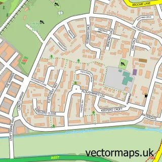
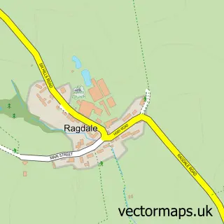
This Thrussington street map is a detailed vector street map covering a 750m x 750m area. Select a larger area to create and download your own vector street map of Thrussington.
The 750-metre map sample for Thrussington covers 213 mapped buildings and approximately 23.0 km of road detail, of which 12 named roads are named. The immediate area includes 1 school, 2 pubs and 2 MOT stations within 2 miles. The wider area around Thrussington features 1 tourism point of interest, 3 food and drink venues and 2 hotels. To create a larger or custom map of Thrussington, the map builder lets you define your own coverage area and download editable SVG, PDF and PNG files.
Create a larger editable map of Thrussington
Choose any area you need and generate a high-quality vector map instantly. Perfect for print, planning, design, business and personal use.

This Thrussington street map in Leicestershire is available as downloadable SVG, PDF and PNG map files, or as a printed map for planning, business, display, education, local information and design work. You can also create a larger custom map area using the map selector.
What this Thrussington map sample shows
Thrussington lies within Thrussington Cp parish, part of Wreake Villages ward in the Charnwood District (B) local authority area. The postcode geography for this area includes the LE postcode area, the LE7 postcode district and the LE7 4 postcode sector. Residents fall under the Nhs Leicester, Leicestershire And Rutland Integrated Care Board for NHS services.
Local features near Thrussington
Within 2 milesAmenities and services in and around Thrussington.
Administrative and postcode information for Thrussington
Thrussington lies within Thrussington Cp parish, part of Wreake Villages ward in the Charnwood District (B) local authority area. The postcode geography for this area includes the LE postcode area, the LE7 postcode district and the LE7 4 postcode sector. Residents fall under the Nhs Leicester, Leicestershire And Rutland Integrated Care Board for NHS services.
Nearby street map samples around Thrussington

More street maps in Leicestershire
750 metre map area coverage
Boundary, postcode and point of interest information for the 750m x 750m rectangle centred on this sample map.
Boundaries containing map centre
Constituency: Melton and Syston Co Const
County: Leicestershire County
District: Charnwood District (B)
Icb: NHS Leicester Leicestershire and Rutland ICB
Parish: Thrussington CP
Police Force: leicestershire
Postcode District: LE7
Postcode Sector: LE7 4
Ward: Wreake Valley Ward
Nearby boundaries intersecting sample
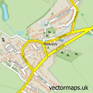
Parish: Rearsby CP
Postcode coverage
POI category counts
Equestrian Facility: 2
Hotel: 2
Pub: 2
Advertising Agency: 1
Anglican Church: 1
Artificial Turf: 1
Campground: 1
Contractor: 1
Convenience Store: 1
Dairy Farm: 1
Sample points of interest
- Hackney Marketing Consultants
- Thrussington: Holy Trinity
- Lawnscape
- Hill Top Caravan Park
- Martin Block Paving
- Thrussington's Village Store, Deli and Tearoom
- Manor Farm Dairy Products
- Thrussington Church of England Primary School
- SQ Equestrian Products
- Slipquiz
- Wreake Valley Craftsmen
- Starr Inn Thrussington.
Create a larger editable map of Thrussington
This sample shows only a 750 metre area. To create a larger map of Thrussington, use our map builder to choose your own coverage area, add titles and download editable SVG, PDF and PNG files.
Create a custom map of Thrussington