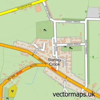
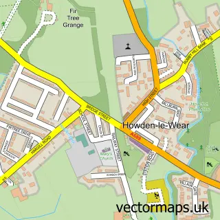
This Tow Law street map is a detailed vector street map covering a 750m x 750m area. Select a larger area to create and download your own vector street map of Tow Law.
The 750-metre map sample for Tow Law covers 235 mapped buildings and approximately 11.9 km of road detail, of which 20 named roads are named. The immediate area includes 1 school, 2 pubs and 1 MOT station within 2 miles. The wider area around Tow Law features 1 tourism point of interest, 5 food and drink venues and 1 hotel. To create a larger or custom map of Tow Law, the map builder lets you define your own coverage area and download editable SVG, PDF and PNG files.
Create a larger editable map of Tow Law
Choose any area you need and generate a high-quality vector map instantly. Perfect for print, planning, design, business and personal use.

This Tow Law street map in Durham is available as downloadable SVG, PDF and PNG map files, or as a printed map for planning, business, display, education, local information and design work. You can also create a larger custom map area using the map selector.
What this Tow Law map sample shows
Tow Law lies within Tow Law Cp parish, part of Tow Law ward in the County Durham local authority area. The postcode geography for this area includes the DL postcode area, the DL13 postcode district and the DL13 4 postcode sector. Residents fall under the Nhs North East And North Cumbria Integrated Care Board for NHS services.
Local features near Tow Law
Within 2 milesAmenities and services in and around Tow Law.
Administrative and postcode information for Tow Law
Tow Law lies within Tow Law Cp parish, part of Tow Law ward in the County Durham local authority area. The postcode geography for this area includes the DL postcode area, the DL13 postcode district and the DL13 4 postcode sector. Residents fall under the Nhs North East And North Cumbria Integrated Care Board for NHS services.
Nearby street map samples around Tow Law

More street maps in Durham
750 metre map area coverage
Boundary, postcode and point of interest information for the 750m x 750m rectangle centred on this sample map.
Boundaries containing map centre
Constituency: Bishop Auckland Co Const
District: County Durham
Icb: NHS North East and North Cumbria ICB
Parish: Tow Law CP
Police Force: durham
Postcode District: DL13
Postcode Sector: DL13 4
Nearby boundaries intersecting sample
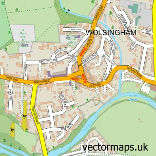
Parish: Wolsingham CP
Postcode coverage
POI category counts
Convenience Store: 4
Bakery: 2
Beauty Salon: 2
Books Mags Music And Video: 2
Cafe: 2
Pub: 2
Atms: 1
Audio Visual Equipment Store: 1
Auto Glass Service: 1
Bar: 1
Sample points of interest
- The Cooperative Food (BF) Tow Law, Tow Law
- Just Jukin
- ML Windscreens
- Greggs
- Pages Bakery
- The Rabbit Hole
- TEN. Barbers
- Beauty by Ellie
- Andromedas Beauty
- Her's & Sir's Hair and Beauty Salon
- Post Office-Tow Law
- Tow Law Post Office
Create a larger editable map of Tow Law
This sample shows only a 750 metre area. To create a larger map of Tow Law, use our map builder to choose your own coverage area, add titles and download editable SVG, PDF and PNG files.
Create a custom map of Tow Law