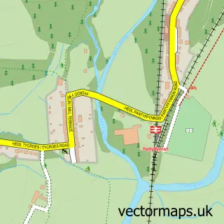
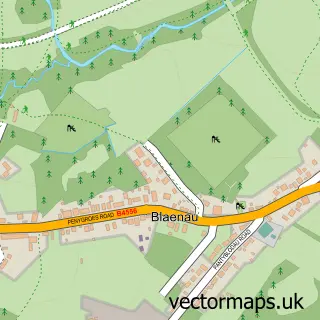
This Tycroes street map is a detailed vector street map covering a 750m x 750m area. Select a larger area to create and download your own vector street map of Tycroes.
The 750-metre map sample for Tycroes covers 403 mapped buildings and approximately 9.4 km of road detail, of which 13 named roads are named. The immediate area includes 1 school, 1 GP surgery and 6 MOT stations within 2 miles. The wider area around Tycroes features 4 food and drink venues. To create a larger or custom map of Tycroes, the map builder lets you define your own coverage area and download editable SVG, PDF and PNG files.
Create a larger editable map of Tycroes
Choose any area you need and generate a high-quality vector map instantly. Perfect for print, planning, design, business and personal use.

This Tycroes street map in Dyfed is available as downloadable SVG, PDF and PNG map files, or as a printed map for planning, business, display, education, local information and design work. You can also create a larger custom map area using the map selector.
What this Tycroes map sample shows
Tycroes lies within Llanedi Community parish, part of Tycroes ward in the Sir Gaerfyrddin - Carmarthenshire local authority area. The postcode geography for this area includes the SA postcode area, the SA18 postcode district and the SA18 3 postcode sector. Residents fall under the Hywel Dda University Health Board for NHS services.
Local features near Tycroes
Within 2 milesAmenities and services in and around Tycroes.
Administrative and postcode information for Tycroes
Tycroes lies within Llanedi Community parish, part of Tycroes ward in the Sir Gaerfyrddin - Carmarthenshire local authority area. The postcode geography for this area includes the SA postcode area, the SA18 postcode district and the SA18 3 postcode sector. Residents fall under the Hywel Dda University Health Board for NHS services.
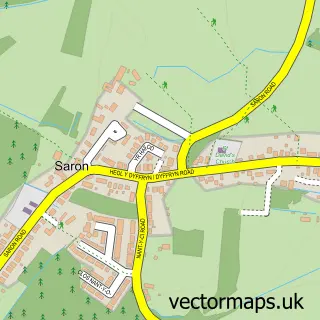
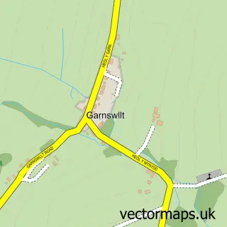
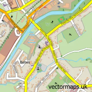
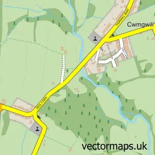
Nearby street map samples around Tycroes

More street maps in Dyfed
750 metre map area coverage
Boundary, postcode and point of interest information for the 750m x 750m rectangle centred on this sample map.
Boundaries containing map centre
Constituency: Llanelli Co Const
District: Sir Gaerfyrddin - Carmarthenshire
Icb: Hywel Dda
Parish: Llanedi Community
Police Force: dyfed-powys
Postcode District: SA18
Postcode Sector: SA18 3
Nearby boundaries intersecting sample
Constituency: Caerfyrddin Co Const
Parish: Llandybie Community
Postcode coverage
POI category counts
Beauty Salon: 5
Cafe: 2
Coffee Shop: 2
Convenience Store: 2
Doctor: 2
Flowers And Gifts Shop: 2
Shipping Center: 2
Accountant: 1
Auto Electrical Repair: 1
Bakery: 1
Sample points of interest
- Unity Accountancy
- A M Electrical
- Higgins Bespoke Cakes
- Alpha Beauty
- Beauty by Katie
- Bellisima Beauty & Aesthetics
- Blown Away Hair Stylist
- Time Out
- G Thomas & Sons
- E Phillips & Sons Ltd.
- Cwtsh Newydd children’s soft play
- Welsh Spice
Create a larger editable map of Tycroes
This sample shows only a 750 metre area. To create a larger map of Tycroes, use our map builder to choose your own coverage area, add titles and download editable SVG, PDF and PNG files.
Create a custom map of Tycroes