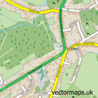
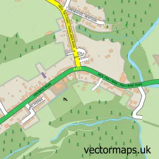
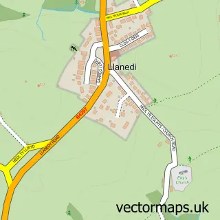
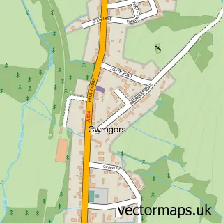
This Garnswllt street map is a detailed vector street map covering a 750m x 750m area. Select a larger area to create and download your own vector street map of Garnswllt.
The 750-metre map sample for Garnswllt covers 52 mapped buildings and approximately 5.2 km of road detail, of which 3 named roads are named. The immediate area includes 1 GP surgery within 2 miles and 3 MOT stations within 2 miles. To create a larger or custom map of Garnswllt, the map builder lets you define your own coverage area and download editable SVG, PDF and PNG files.
Create a larger editable map of Garnswllt
Choose any area you need and generate a high-quality vector map instantly. Perfect for print, planning, design, business and personal use.

This Garnswllt street map in West Glamorgan is available as downloadable SVG, PDF and PNG map files, or as a printed map for planning, business, display, education, local information and design work. You can also create a larger custom map area using the map selector.
What this Garnswllt map sample shows
Garnswllt lies within Llanedi Community parish, part of Tycroes ward in the Sir Gaerfyrddin - Carmarthenshire local authority area. The postcode geography for this area includes the SA postcode area, the SA18 postcode district and the SA18 3 postcode sector. Residents fall under the Hywel Dda University Health Board for NHS services.
Local features near Garnswllt
Within 2 milesAmenities and services in and around Garnswllt.
Administrative and postcode information for Garnswllt
Garnswllt lies within Llanedi Community parish, part of Tycroes ward in the Sir Gaerfyrddin - Carmarthenshire local authority area. The postcode geography for this area includes the SA postcode area, the SA18 postcode district and the SA18 3 postcode sector. Residents fall under the Hywel Dda University Health Board for NHS services.
Nearby street map samples around Garnswllt

More street maps in West Glamorgan
750 metre map area coverage
Boundary, postcode and point of interest information for the 750m x 750m rectangle centred on this sample map.
Boundaries containing map centre
Constituency: Gower Co Const
District: Abertawe - Swansea
Icb: Abertawe Bro Morgannwg University
Parish: Mawr Community
Police Force: south wales
Postcode District: SA18
Postcode Sector: SA18 2
Nearby boundaries intersecting sample
No additional intersecting boundaries found.
Postcode coverage
POI category counts
Professional Services: 1
Sample points of interest
- Kevin John Photography
Create a larger editable map of Garnswllt
This sample shows only a 750 metre area. To create a larger map of Garnswllt, use our map builder to choose your own coverage area, add titles and download editable SVG, PDF and PNG files.
Create a custom map of Garnswllt