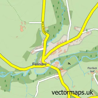
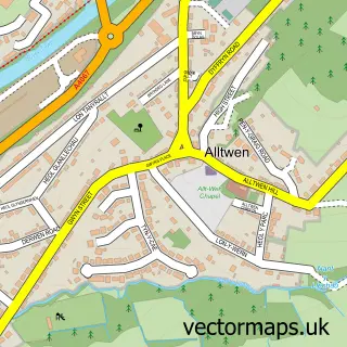
This Craig-cefn-parc street map is a detailed vector street map covering a 750m x 750m area. Select a larger area to create and download your own vector street map of Craig-cefn-parc.
The 750-metre map sample for Craig-cefn-parc covers 208 mapped buildings and approximately 13.3 km of road detail, of which 11 named roads are named. The immediate area includes 4 MOT stations within 2 miles. The wider area around Craig-cefn-parc features 2 tourism points of interest. To create a larger or custom map of Craig-cefn-parc, the map builder lets you define your own coverage area and download editable SVG, PDF and PNG files.
Create a larger editable map of Craig-cefn-parc
Choose any area you need and generate a high-quality vector map instantly. Perfect for print, planning, design, business and personal use.

This Craig-cefn-parc street map in West Glamorgan is available as downloadable SVG, PDF and PNG map files, or as a printed map for planning, business, display, education, local information and design work. You can also create a larger custom map area using the map selector.
What this Craig-cefn-parc map sample shows
Craig-cefn-parc lies within Mawr Community parish, part of Mawr ward in the Abertawe - Swansea local authority area. The postcode geography for this area includes the SA postcode area, the SA6 postcode district and the SA6 5 postcode sector. Residents fall under the Swansea Bay University Local Health Board for NHS services.
Local features near Craig-cefn-parc
Within 2 milesAmenities and services in and around Craig-cefn-parc.
Administrative and postcode information for Craig-cefn-parc
The local authority covering Craig-cefn-parc is Abertawe - Swansea, within the county of West Glamorgan. The settlement lies within Mawr ward and Mawr Community civil parish. The SA6 postcode district and SA6 5 postcode sector serve the immediate area. NHS provision in the area is delivered through Swansea Bay University Health Board.
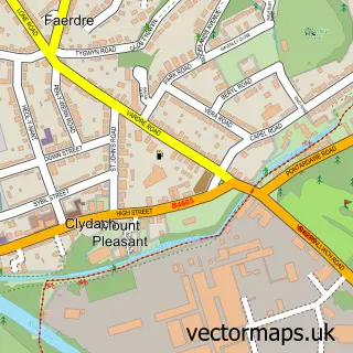
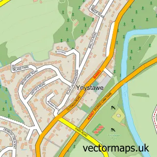
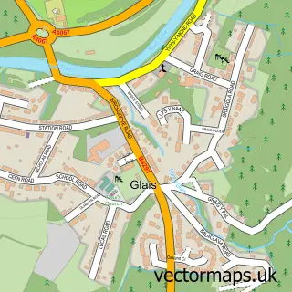
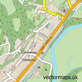
Nearby street map samples around Craig-cefn-parc

More street maps in West Glamorgan
750 metre map area coverage
Boundary, postcode and point of interest information for the 750m x 750m rectangle centred on this sample map.
Boundaries containing map centre
Constituency: Gower Co Const
District: Abertawe - Swansea
Icb: Abertawe Bro Morgannwg University
Parish: Mawr Community
Police Force: south wales
Postcode District: SA6
Postcode Sector: SA6 5
Nearby boundaries intersecting sample
No additional intersecting boundaries found.
Postcode coverage
POI category counts
Post Office: 3
Accommodation: 1
Accountant: 1
Boutique: 1
Dentist: 1
Driving School: 1
Landmark And Historical Building: 1
Package Locker: 1
Park: 1
Photographer: 1
Sample points of interest
- Tŷ Howton
- Renesto & Co Accountants
- Leeanne's Boutique
- Ceramics 2000
- Karl's School of Motoring
- Cathelyd Newydd
- InPost
- Craig Cefn Parc Community Garden
- Bernard Mitchell
- Celtic Ost
- Craig Cefn Post Office
- Post Office
Create a larger editable map of Craig-cefn-parc
This sample shows only a 750 metre area. To create a larger map of Craig-cefn-parc, use our map builder to choose your own coverage area, add titles and download editable SVG, PDF and PNG files.
Create a custom map of Craig-cefn-parc