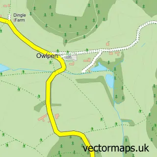
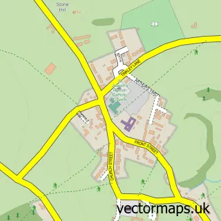
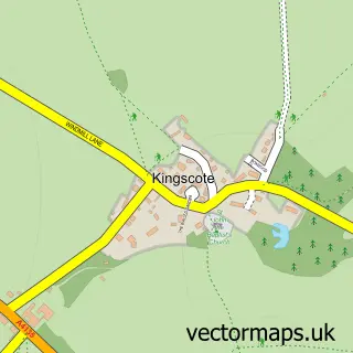
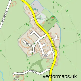
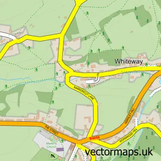
This Uley street map is a detailed vector street map covering a 750m x 750m area. Select a larger area to create and download your own vector street map of Uley.
The 750-metre map sample for Uley covers 254 mapped buildings and approximately 8.4 km of road detail, of which 14 named roads are named. The immediate area includes 1 school, 1 pub and 2 MOT stations within 2 miles. The wider area around Uley features 1 tourism point of interest and 1 food and drink venue. To create a larger or custom map of Uley, the map builder lets you define your own coverage area and download editable SVG, PDF and PNG files.
Create a larger editable map of Uley
Choose any area you need and generate a high-quality vector map instantly. Perfect for print, planning, design, business and personal use.

This Uley street map in Gloucestershire is available as downloadable SVG, PDF and PNG map files, or as a printed map for planning, business, display, education, local information and design work. You can also create a larger custom map area using the map selector.
What this Uley map sample shows
Uley lies within Uley Cp parish, part of Coaley And Uley ward in the Stroud District local authority area. The postcode geography for this area includes the GL postcode area, the GL11 postcode district and the GL11 5 postcode sector. Residents fall under the Nhs Gloucestershire Integrated Care Board for NHS services.
Local features near Uley
Within 2 milesAmenities and services in and around Uley.
Administrative and postcode information for Uley
The local authority covering Uley is Stroud District, within the county of Gloucestershire. The settlement lies within Coaley And Uley ward and Uley Cp civil parish. The GL11 postcode district and GL11 5 postcode sector serve the immediate area. NHS provision in the area is delivered through Gloucestershire Hospitals Nhs Foundation Trust.
Nearby street map samples around Uley

More street maps in Gloucestershire
750 metre map area coverage
Boundary, postcode and point of interest information for the 750m x 750m rectangle centred on this sample map.
Boundaries containing map centre
Constituency: Stroud Co Const
County: Gloucestershire County
District: Stroud District
Icb: NHS Gloucestershire ICB
Parish: Uley CP
Police Force: gloucestershire
Postcode District: GL11
Postcode Sector: GL11 5
Ward: Coaley & Uley Ward
Nearby boundaries intersecting sample
No additional intersecting boundaries found.
Postcode coverage
POI category counts
Building Supply Store: 3
Elementary School: 2
It Service And Computer Repair: 2
Alternative Medicine: 1
Brewery: 1
Business: 1
Carpenter: 1
Church Cathedral: 1
Community Services Non Profits: 1
Contractor: 1
Sample points of interest
- Michael Brimacombe Massage Therapist
- Uley Brewery
- Cotswold Chimneys
- JMS Landscapes
- Pro-Scaff (South West) Ltd.
- Karen Hilliard Artist
- Matt Summers Furniture
- St Giles Church
- Uley Community Stores Ltd
- LRS Building Contractors
- Post Office Travel Money
- Uley Under 5s
Create a larger editable map of Uley
This sample shows only a 750 metre area. To create a larger map of Uley, use our map builder to choose your own coverage area, add titles and download editable SVG, PDF and PNG files.
Create a custom map of Uley