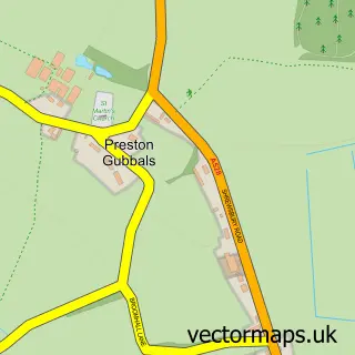
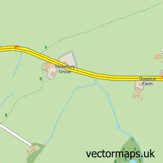
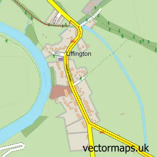
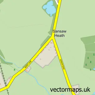
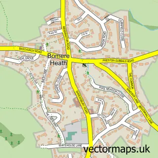
This Upper Battlefield street map is a detailed vector street map covering a 750m x 750m area. Select a larger area to create and download your own vector street map of Upper Battlefield.
The 750-metre map sample for Upper Battlefield covers 53 mapped buildings and approximately 2.4 km of road detail, of which 1 named road are named. The immediate area includes 1 GP surgery within 2 miles and 27 MOT stations within 2 miles. The wider area around Upper Battlefield features 1 tourism point of interest, 1 food and drink venue and 1 hotel. To create a larger or custom map of Upper Battlefield, the map builder lets you define your own coverage area and download editable SVG, PDF and PNG files.
Create a larger editable map of Upper Battlefield
Choose any area you need and generate a high-quality vector map instantly. Perfect for print, planning, design, business and personal use.

This Upper Battlefield street map in Shropshire is available as downloadable SVG, PDF and PNG map files, or as a printed map for planning, business, display, education, local information and design work. You can also create a larger custom map area using the map selector.
What this Upper Battlefield map sample shows
Upper Battlefield lies within Shrewsbury Cp parish, part of Battlefield ward in the Shropshire local authority area. The postcode geography for this area includes the SY postcode area, the SY1 postcode district and the SY1 4 postcode sector. Residents fall under the Nhs Shropshire, Telford And Wrekin Integrated Care Board for NHS services.
Local features near Upper Battlefield
Within 2 milesAmenities and services in and around Upper Battlefield.
Administrative and postcode information for Upper Battlefield
Upper Battlefield lies within Shrewsbury Cp parish, part of Battlefield ward in the Shropshire local authority area. The postcode geography for this area includes the SY postcode area, the SY1 postcode district and the SY1 4 postcode sector. Residents fall under the Nhs Shropshire, Telford And Wrekin Integrated Care Board for NHS services.
Nearby street map samples around Upper Battlefield

More street maps in Shropshire
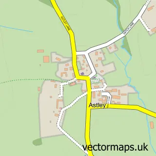
750 metre map area coverage
Boundary, postcode and point of interest information for the 750m x 750m rectangle centred on this sample map.
Boundaries containing map centre
Constituency: Shrewsbury Co Const
District: Shropshire
Icb: NHS Shropshire Telford and Wrekin ICB
Parish: Astley CP
Police Force: west mercia
Postcode District: SY4
Postcode Sector: SY4 4
Nearby boundaries intersecting sample
Parish: Bomere Heath and District CP
Postcode Sector: SY4 3
Postcode coverage
POI category counts
Bridal Shop: 1
Building Supply Store: 1
Cafe: 1
Campground: 1
Cosmetic And Beauty Supplies: 1
Electrician: 1
French Restaurant: 1
Hotel: 1
Wildlife Sanctuary: 1
Sample points of interest
- Emma-Lou Prom
- Kohring Plumbing and Heating
- Battlefield 1403
- Beaconsfield Holiday Park
- SHE Lash UK
- APD Pat Testing
- The Bothy Restaurant
- Wellington Hall
- Battlefield Bird of Prey Centre
Create a larger editable map of Upper Battlefield
This sample shows only a 750 metre area. To create a larger map of Upper Battlefield, use our map builder to choose your own coverage area, add titles and download editable SVG, PDF and PNG files.
Create a custom map of Upper Battlefield