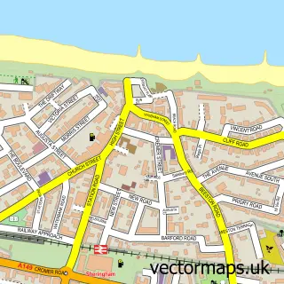
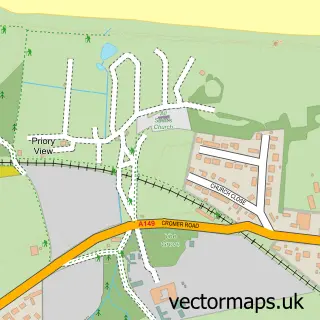
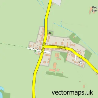
This Upper Sheringham street map is a detailed vector street map covering a 750m x 750m area. Select a larger area to create and download your own vector street map of Upper Sheringham.
The 750-metre map sample for Upper Sheringham covers 95 mapped buildings and approximately 11.6 km of road detail, of which 11 named roads are named. The immediate area includes 1 GP surgery within 2 miles and 4 MOT stations within 2 miles. The wider area around Upper Sheringham features 1 tourism point of interest and 1 campsite within 2 miles. To create a larger or custom map of Upper Sheringham, the map builder lets you define your own coverage area and download editable SVG, PDF and PNG files.
Create a larger editable map of Upper Sheringham
Choose any area you need and generate a high-quality vector map instantly. Perfect for print, planning, design, business and personal use.

This Upper Sheringham street map in Norfolk is available as downloadable SVG, PDF and PNG map files, or as a printed map for planning, business, display, education, local information and design work. You can also create a larger custom map area using the map selector.
What this Upper Sheringham map sample shows
Upper Sheringham lies within Upper Sheringham Cp parish, part of Sheringham South ward in the North Norfolk District local authority area. The postcode geography for this area includes the NR postcode area, the NR26 postcode district and the NR26 8 postcode sector. Residents fall under the Nhs Norfolk And Waveney Integrated Care Board for NHS services.
Local features near Upper Sheringham
Within 2 milesAmenities and services in and around Upper Sheringham.
Administrative and postcode information for Upper Sheringham
The local authority covering Upper Sheringham is North Norfolk District, within the county of Norfolk. The settlement lies within Sheringham South ward and Upper Sheringham Cp civil parish. The NR26 postcode district and NR26 8 postcode sector serve the immediate area. NHS provision in the area is delivered through Norfolk And Norwich University Hospitals Nhs Foundation Trust.
Nearby street map samples around Upper Sheringham

More street maps in Norfolk
750 metre map area coverage
Boundary, postcode and point of interest information for the 750m x 750m rectangle centred on this sample map.
Boundaries containing map centre
Constituency: North Norfolk Co Const
County: Norfolk County
District: North Norfolk District
Icb: NHS Norfolk and Waveney ICB
Parish: Upper Sheringham CP
Police Force: norfolk
Postcode District: NR26
Postcode Sector: NR26 8
Ward: Sheringham South Ward
Nearby boundaries intersecting sample
Parish: Sheringham CP
Postcode coverage
POI category counts
Bed And Breakfast: 2
Accountant: 1
Alternative Medicine: 1
Anglican Church: 1
Church Cathedral: 1
Dance School: 1
Financial Service: 1
Landmark And Historical Building: 1
Naturopathic Holistic: 1
Pet Sitting: 1
Sample points of interest
- NL Accountancy & Bookkeeping Services
- Seasons Health
- Upper Sheringham: All Saints
- Dales Country House Hotel
- The Dales Country House Hotel
- All Saints Church
- Sound Waves Dance School
- Nicola Lamb Accountancy & Bookeeping
- Upper Sheringham Village Well
- Lavencia
- Stylish Strides Pet Services
- Sheringham Estate
Create a larger editable map of Upper Sheringham
This sample shows only a 750 metre area. To create a larger map of Upper Sheringham, use our map builder to choose your own coverage area, add titles and download editable SVG, PDF and PNG files.
Create a custom map of Upper Sheringham