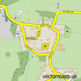
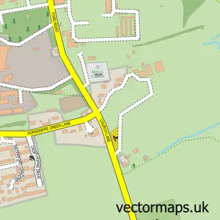
This Walberton street map is a detailed vector street map covering a 750m x 750m area. Select a larger area to create and download your own vector street map of Walberton.
The 750-metre map sample for Walberton covers 347 mapped buildings and approximately 6.5 km of road detail, of which 14 named roads are named. The immediate area includes 1 school, 2 GP surgeries within 2 miles, 2 pubs and 4 MOT stations within 2 miles. The wider area around Walberton features 3 tourism points of interest, 2 food and drink venues and 2 campsites within 2 miles. To create a larger or custom map of Walberton, the map builder lets you define your own coverage area and download editable SVG, PDF and PNG files.
Create a larger editable map of Walberton
Choose any area you need and generate a high-quality vector map instantly. Perfect for print, planning, design, business and personal use.

This Walberton street map in West Sussex is available as downloadable SVG, PDF and PNG map files, or as a printed map for planning, business, display, education, local information and design work. You can also create a larger custom map area using the map selector.
What this Walberton map sample shows
Walberton lies within Walberton Cp parish, part of Arundel & Walberton ward in the Arun District local authority area. The postcode geography for this area includes the BN postcode area, the BN18 postcode district and the BN18 0 postcode sector. Residents fall under the Nhs Sussex Integrated Care Board for NHS services.
Local features near Walberton
Within 2 milesAmenities and services in and around Walberton.
Administrative and postcode information for Walberton
Walberton lies within Walberton Cp parish, part of Arundel & Walberton ward in the Arun District local authority area. The postcode geography for this area includes the BN postcode area, the BN18 postcode district and the BN18 0 postcode sector. Residents fall under the Nhs Sussex Integrated Care Board for NHS services.
Nearby street map samples around Walberton

More street maps in West Sussex
750 metre map area coverage
Boundary, postcode and point of interest information for the 750m x 750m rectangle centred on this sample map.
Boundaries containing map centre
Constituency: Arundel and South Downs Co Const
County: West Sussex County
District: Arun District
Icb: NHS Surrey and Sussex ICB
Parish: Walberton CP
Police Force: sussex
Postcode District: BN18
Postcode Sector: BN18 0
Ward: Arundel & Walberton Ward
Nearby boundaries intersecting sample
No additional intersecting boundaries found.
Postcode coverage
POI category counts
Art Gallery: 2
Business Consulting: 2
Education: 2
Pub: 2
Shipping Center: 2
Advertising Agency: 1
Anglican Church: 1
Architect: 1
Automotive Repair: 1
Beauty Salon: 1
Sample points of interest
- A M Associates
- St Mary
- Helyer Davies Architects Ltd.
- Forge Gallery
- Jonathan Waights Ceramics
- Turnpike Motors
- Murroes Hairdressing
- David Wilson Homes - Sylvan Meadows
- Forge Gallery
- Bcs International
- Sustrel Consultancy
- Evolution Vehicles
Create a larger editable map of Walberton
This sample shows only a 750 metre area. To create a larger map of Walberton, use our map builder to choose your own coverage area, add titles and download editable SVG, PDF and PNG files.
Create a custom map of Walberton