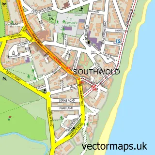
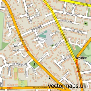
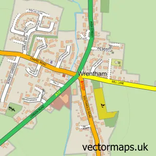
This Wangford street map is a detailed vector street map covering a 750m x 750m area. Select a larger area to create and download your own vector street map of Wangford.
The 750-metre map sample for Wangford covers 163 mapped buildings and approximately 11.9 km of road detail, of which 10 named roads are named. The immediate area includes 1 pub and 2 MOT stations within 2 miles. The wider area around Wangford features 1 food and drink venue. To create a larger or custom map of Wangford, the map builder lets you define your own coverage area and download editable SVG, PDF and PNG files.
Create a larger editable map of Wangford
Choose any area you need and generate a high-quality vector map instantly. Perfect for print, planning, design, business and personal use.

This Wangford street map in Suffolk is available as downloadable SVG, PDF and PNG map files, or as a printed map for planning, business, display, education, local information and design work. You can also create a larger custom map area using the map selector.
What this Wangford map sample shows
Wangford lies within Wangford With Henham Cp parish, part of Wrentham, Wangford & Westleton ward in the East Suffolk District local authority area. The postcode geography for this area includes the NR postcode area, the NR34 postcode district and the NR34 8 postcode sector. Residents fall under the Nhs Norfolk And Waveney Integrated Care Board for NHS services.
Local features near Wangford
Within 2 milesAmenities and services in and around Wangford.
Administrative and postcode information for Wangford
Wangford lies within Wangford With Henham Cp parish, part of Wrentham, Wangford & Westleton ward in the East Suffolk District local authority area. The postcode geography for this area includes the NR postcode area, the NR34 postcode district and the NR34 8 postcode sector. Residents fall under the Nhs Norfolk And Waveney Integrated Care Board for NHS services.
Nearby street map samples around Wangford

More street maps in Suffolk
750 metre map area coverage
Boundary, postcode and point of interest information for the 750m x 750m rectangle centred on this sample map.
Boundaries containing map centre
Constituency: Suffolk Coastal Co Const
County: Suffolk County
District: East Suffolk District
Icb: NHS Norfolk and Waveney ICB
Parish: Wangford with Henham CP
Police Force: suffolk
Postcode District: NR34
Postcode Sector: NR34 8
Ward: Wrentham, Wangford & Westleton Ward
Nearby boundaries intersecting sample
Parish: Uggeshall CP
Postcode coverage
POI category counts
Convenience Store: 2
Religious Organization: 2
Veterinarian: 2
Anglican Church: 1
Doctor: 1
Farmers Market: 1
Gift Shop: 1
Home Cleaning: 1
Pub: 1
Septic Services: 1
Sample points of interest
- Wangford, St Peter & St Paul
- Spar
- The Village Store
- Longshore Surgeries - Wangford
- Wangford Farm Shop
- Heritage Hideaways Ltd.
- Coastal Window Cleaning
- The Angel Inn
- St Peter and St Paul, Wangford
- Wangford Priory
- Cox Construction & Groundworks Ltd.
- Wangford Post Office
Create a larger editable map of Wangford
This sample shows only a 750 metre area. To create a larger map of Wangford, use our map builder to choose your own coverage area, add titles and download editable SVG, PDF and PNG files.
Create a custom map of Wangford