Vector Maps logo
Home Why it works Popular maps Districts Samples Customizer Create Your Map
VectorMaps.uk
Home Popular maps Districts Samples Customizer Create Your Map Privacy Disclaimer
Home / UK Maps / Northumberland / Wark Map

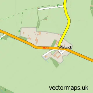
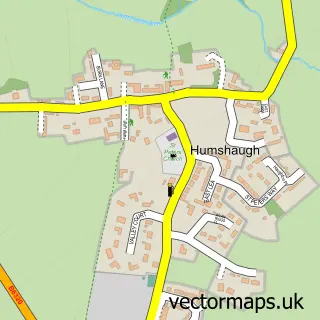
This Wark street map is a detailed vector street map covering a 750m x 750m area. Select a larger area to create and download your own vector street map of Wark.

Wark is a village in Northumberland, in the North East of England. The settlement falls within the Hexham parliamentary constituency. It is served by the NE48 postcode district, with NE48 3 as the local postcode sector.

The 750-metre map sample for Wark covers 159 mapped buildings and approximately 11.6 km of road detail, of which 7 named roads are named. The immediate area includes 1 school and 1 pub. The wider area around Wark features 1 tourism point of interest, 1 food and drink venue and 3 hotels. To create a larger or custom map of Wark, the map builder lets you define your own coverage area and download editable SVG, PDF and PNG files.

159Buildings
11.56 kmRoads
7Named roads
359Residents within 2 miles
Create your own

Create a larger editable map of Wark

Choose any area you need and generate a high-quality vector map instantly. Perfect for print, planning, design, business and personal use.

Choose any location
Editable SVG files
Any size up to A0
PDF, PNG & more
Instant download
High quality guaranteed
Create My Custom Map
Secure, private & no credit card required
Wark Vector Street Map
750m Sample
Wark vector street map sample showing roads, buildings and local features in a 750 metre preview area
Buy Wark Map Print from £12.95 Buy Wark Digital Map from £6

This Wark street map in Northumberland is available as downloadable SVG, PDF and PNG map files, or as a printed map for planning, business, display, education, local information and design work. You can also create a larger custom map area using the map selector.

What this Wark map sample shows

Wark lies within Wark Cp parish, part of Humshaugh ward in the Northumberland local authority area. The postcode geography for this area includes the NE postcode area, the NE48 postcode district and the NE48 3 postcode sector. Residents fall under the Nhs North East And North Cumbria Integrated Care Board for NHS services.

Local features near Wark

Within 2 miles

Amenities and services in and around Wark.

1 Schools
1 Tourism & leisure
1 Food & drink
1 Pubs
3 Hotels
1 Healthcare POIs

Counts are approximate and based on publicly available data.

Administrative and postcode information for Wark

The local authority covering Wark is Northumberland, within the county of Northumberland. The settlement lies within Humshaugh ward and Wark Cp civil parish. The NE48 postcode district and NE48 3 postcode sector serve the immediate area. NHS provision in the area is delivered through Northumbria Healthcare Nhs Foundation Trust.

Parish Wark CP
Ward Humshaugh
District / local authority Northumberland
County Northumberland
Historic county Northumberland
Postcode district NE48
Postcode sector NE48 3
Parliamentary constituency Hexham
Region North East
Country England

Nearby street map samples around Wark

Street map sample of Hexham, Northumberland Hexham Town - Northumberland - 9.3 miles Street map sample of Newcastle upon Tyne, Tyne & Wear Newcastle upon Tyne City - Tyne & Wear - 25.3 miles Street map sample of Birtley, Northumberland Birtley Village - Northumberland - 1.4 miles Street map sample of Simonburn, Northumberland Simonburn Village - Northumberland - 2.2 miles Street map sample of Gunnerton, Northumberland Gunnerton Village - Northumberland - 3.1 miles Street map sample of Redesmouth, Northumberland Redesmouth Village - Northumberland - 3.2 miles Street map sample of Bellingham, Northumberland Bellingham Village - Northumberland - 4.1 miles Street map sample of Barrasford, Northumberland Barrasford Village - Northumberland - 4.2 miles Street map sample of Walwick, Northumberland Walwick Village - Northumberland - 4.8 miles Street map sample of Humshaugh, Northumberland Humshaugh Village - Northumberland - 5.1 miles

More street maps in Northumberland

Street map sample of Birtley, Northumberland Birtley Village - 1.4 miles Street map sample of Simonburn, Northumberland Simonburn Village - 2.2 miles Street map sample of Gunnerton, Northumberland Gunnerton Village - 3.1 miles Street map sample of Redesmouth, Northumberland Redesmouth Village - 3.2 miles Street map sample of Bellingham, Northumberland Bellingham Village - 4.1 miles

750 metre map area coverage

Boundary, postcode and point of interest information for the 750m x 750m rectangle centred on this sample map.

Boundaries containing map centre

Constituency: Hexham Co Const

District: Northumberland

Icb: NHS North East and North Cumbria ICB

Parish: Wark CP

Police Force: northumberland

Postcode District: NE48

Postcode Sector: NE48 3

Nearby boundaries intersecting sample
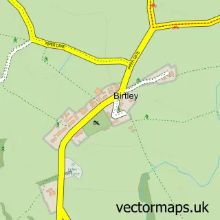
Parish: Birtley CP

Postcode coverage

NE48 NE48 3

POI category counts

Convenience Store: 4

Hotel: 3

Anglican Church: 1

Arts And Entertainment: 1

Bridge: 1

Building Supply Store: 1

Business Management Services: 1

Butcher Shop: 1

Doctor: 1

Gardener: 1

Sample points of interest

  • Humshaugh Parishes Anglican Church
  • Wark Arts And Entertainment
  • Wark Bridge Bridge
  • Pure Energy Systems Building Supply Store
  • Sg Quality Engineering Business Management Services
  • Wark Village Butchers Butcher Shop
  • One Stop Convenience Store
  • Post Office-Wark Convenience Store
  • Premier Convenience Store
  • Wark Post Office Convenience Store
  • Wark Surgery Doctor
  • R a Charlton Gardener

Create a larger editable map of Wark

This sample shows only a 750 metre area. To create a larger map of Wark, use our map builder to choose your own coverage area, add titles and download editable SVG, PDF and PNG files.

Create a custom map of Wark

Phone 01751 473136 | Copyright Vectormaps.uk 2026

Samples Customizer Privacy Disclaimer
Wark Vector Street Map
Wark enlarged street map sample showing a 750 metre preview area