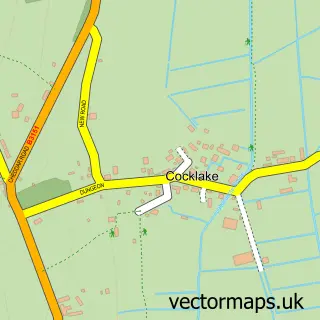
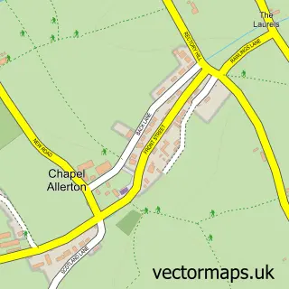
This Wedmore street map is a detailed vector street map covering a 750m x 750m area. Select a larger area to create and download your own vector street map of Wedmore.
The 750-metre map sample for Wedmore covers 420 mapped buildings and approximately 14.2 km of road detail, of which 30 named roads are named. The immediate area includes 2 pubs and 2 MOT stations within 2 miles. The wider area around Wedmore features 6 food and drink venues, 1 hotel and 1 campsite within 2 miles. To create a larger or custom map of Wedmore, the map builder lets you define your own coverage area and download editable SVG, PDF and PNG files.
Create a larger editable map of Wedmore
Choose any area you need and generate a high-quality vector map instantly. Perfect for print, planning, design, business and personal use.

This Wedmore street map in Somerset is available as downloadable SVG, PDF and PNG map files, or as a printed map for planning, business, display, education, local information and design work. You can also create a larger custom map area using the map selector.
What this Wedmore map sample shows
Wedmore lies within Wedmore Cp parish, part of Wedmore And Mark ward in the Somerset local authority area. The postcode geography for this area includes the BS postcode area, the BS28 postcode district and the BS28 4 postcode sector. Residents fall under the Nhs Somerset Integrated Care Board for NHS services.
Local features near Wedmore
Within 2 milesAmenities and services in and around Wedmore.
Administrative and postcode information for Wedmore
The local authority covering Wedmore is Somerset, within the county of Somerset. The settlement lies within Wedmore And Mark ward and Wedmore Cp civil parish. The BS28 postcode district and BS28 4 postcode sector serve the immediate area. NHS provision in the area is delivered through University Hospitals Bristol And Weston Nhs Foundation Trust.
Nearby street map samples around Wedmore


More street maps in Somerset
750 metre map area coverage
Boundary, postcode and point of interest information for the 750m x 750m rectangle centred on this sample map.
Boundaries containing map centre
Constituency: Wells and Mendip Hills Co Const
District: Somerset
Icb: NHS Somerset ICB
Parish: Wedmore CP
Police Force: avon and somerset
Postcode District: BS28
Postcode Sector: BS28 4
Nearby boundaries intersecting sample
No additional intersecting boundaries found.
Postcode coverage
POI category counts
Hair Salon: 6
Professional Services: 5
Church Cathedral: 3
Clothing Store: 3
Contractor: 3
Real Estate Agent: 3
Art Gallery: 2
Atms: 2
Coffee Shop: 2
Flowers And Gifts Shop: 2
Sample points of interest
- ChudleyStone Chartered Certified Accountants
- Zenergise
- Benjamin & Beauchamp Architects
- benjamin+beauchamp architects
- The Artist's Gallery
- The Cottage Gallery
- Wedmore Opera
- Natwest
- PayPoint
- Lloyds Bank
- Tidboald Blythe - The Barber Company
- Jonathan Weller Hairy & Body Sanctuary
Create a larger editable map of Wedmore
This sample shows only a 750 metre area. To create a larger map of Wedmore, use our map builder to choose your own coverage area, add titles and download editable SVG, PDF and PNG files.
Create a custom map of Wedmore