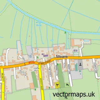
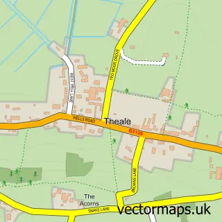
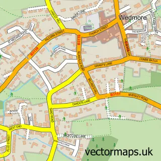
This Westhay street map is a detailed vector street map covering a 750m x 750m area. Select a larger area to create and download your own vector street map of Westhay.
The 750-metre map sample for Westhay covers 137 mapped buildings and approximately 9.3 km of road detail, of which 5 named roads are named. The wider area around Westhay features 1 tourism point of interest, 1 food and drink venue and 1 hotel. To create a larger or custom map of Westhay, the map builder lets you define your own coverage area and download editable SVG, PDF and PNG files.
Create a larger editable map of Westhay
Choose any area you need and generate a high-quality vector map instantly. Perfect for print, planning, design, business and personal use.

This Westhay street map in Somerset is available as downloadable SVG, PDF and PNG map files, or as a printed map for planning, business, display, education, local information and design work. You can also create a larger custom map area using the map selector.
What this Westhay map sample shows
Westhay lies within Meare Cp parish, part of Moor ward in the Somerset local authority area. The postcode geography for this area includes the BA postcode area, the BA6 postcode district and the BA6 9 postcode sector. Residents fall under the Nhs Somerset Integrated Care Board for NHS services.
Local features near Westhay
Within 2 milesAmenities and services in and around Westhay.
Administrative and postcode information for Westhay
The local authority covering Westhay is Somerset, within the county of Somerset. The settlement lies within Moor ward and Meare Cp civil parish. The BA6 postcode district and BA6 9 postcode sector serve the immediate area. NHS provision in the area is delivered through Somerset Nhs Foundation Trust.
Nearby street map samples around Westhay
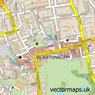

More street maps in Somerset
750 metre map area coverage
Boundary, postcode and point of interest information for the 750m x 750m rectangle centred on this sample map.
Boundaries containing map centre
Constituency: Wells and Mendip Hills Co Const
District: Somerset
Icb: NHS Somerset ICB
Parish: Meare CP
Police Force: avon and somerset
Postcode District: BA6
Postcode Sector: BA6 9
Nearby boundaries intersecting sample
Parish: Wedmore CP
Postcode District: BS28
Postcode Sector: BS28 4
Postcode coverage
POI category counts
Elementary School: 2
Religious Organization: 2
Automotive: 1
Bar: 1
Business Management Services: 1
Chimney Sweep: 1
Construction Services: 1
Counseling And Mental Health: 1
Event Planning: 1
Farm: 1
Sample points of interest
- Dunbavand Car Centre & fords4u.co.uk
- Official Birkenshaw Liberal Club
- R K Aerials
- Blue Hippo
- Baker S C & Sons
- Luma: Stop Overthinking
- The Leys Primary & Nursery School Stevenage
- Trinity Academy New Bridge
- Cruck Tent
- Farmer James Farm Holidays
- Peace-A-Porter
- Artisan Fireplace Design
Create a larger editable map of Westhay
This sample shows only a 750 metre area. To create a larger map of Westhay, use our map builder to choose your own coverage area, add titles and download editable SVG, PDF and PNG files.
Create a custom map of Westhay