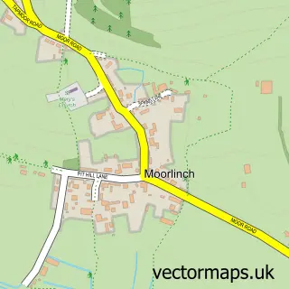
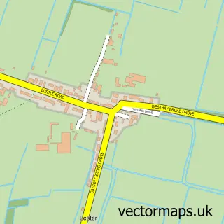
This Catcott street map is a detailed vector street map covering a 750m x 750m area. Select a larger area to create and download your own vector street map of Catcott.
The 750-metre map sample for Catcott covers 291 mapped buildings and approximately 13.7 km of road detail, of which 17 named roads are named. The immediate area includes 1 school, 1 GP surgery within 2 miles and 2 pubs. The wider area around Catcott features 1 tourism point of interest, 2 food and drink venues and 1 campsite within 2 miles. To create a larger or custom map of Catcott, the map builder lets you define your own coverage area and download editable SVG, PDF and PNG files.
Create a larger editable map of Catcott
Choose any area you need and generate a high-quality vector map instantly. Perfect for print, planning, design, business and personal use.

This Catcott street map in Somerset is available as downloadable SVG, PDF and PNG map files, or as a printed map for planning, business, display, education, local information and design work. You can also create a larger custom map area using the map selector.
What this Catcott map sample shows
Catcott lies within Catcott Cp parish, part of West Polden ward in the Somerset local authority area. The postcode geography for this area includes the TA postcode area, the TA7 postcode district and the TA7 9 postcode sector. Residents fall under the Nhs Somerset Integrated Care Board for NHS services.
Local features near Catcott
Within 2 milesAmenities and services in and around Catcott.
Administrative and postcode information for Catcott
Catcott lies within Catcott Cp parish, part of West Polden ward in the Somerset local authority area. The postcode geography for this area includes the TA postcode area, the TA7 postcode district and the TA7 9 postcode sector. Residents fall under the Nhs Somerset Integrated Care Board for NHS services.
Nearby street map samples around Catcott

More street maps in Somerset
750 metre map area coverage
Boundary, postcode and point of interest information for the 750m x 750m rectangle centred on this sample map.
Boundaries containing map centre
Constituency: Wells and Mendip Hills Co Const
District: Somerset
Icb: NHS Somerset ICB
Parish: Catcott CP
Police Force: avon and somerset
Postcode District: TA7
Postcode Sector: TA7 9
Nearby boundaries intersecting sample
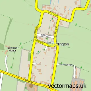
Parish: Edington CP
Postcode coverage
POI category counts
Elementary School: 2
Pub: 2
Anglican Church: 1
Architectural Designer: 1
Assisted Living Facility: 1
Automotive Repair: 1
Barbecue Restaurant: 1
Bed And Breakfast: 1
Bridal Shop: 1
Car Wash: 1
Sample points of interest
- St Peter's Church
- TRE3DOM
- Wellfield House
- Somerset Trimmers
- The Somerset Hog Roast Co
- West Barton House
- Vintage Wheels
- Toms Car Wash
- St Peter's Church
- Briffett & Sons Builders
- Barnetts dairy
- Barnetts Dairy
Create a larger editable map of Catcott
This sample shows only a 750 metre area. To create a larger map of Catcott, use our map builder to choose your own coverage area, add titles and download editable SVG, PDF and PNG files.
Create a custom map of Catcott