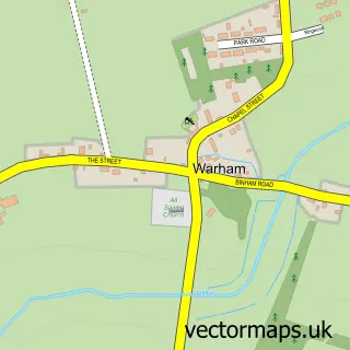
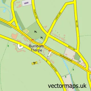
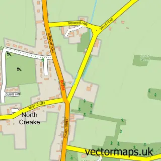
This Wells-next-the-Sea street map is a detailed vector street map covering a 750m x 750m area. Select a larger area to create and download your own vector street map of Wells-next-the-Sea.
The 750-metre map sample for Wells-next-the-Sea covers 500 mapped buildings and approximately 21.4 km of road detail, of which 44 named roads are named. The immediate area includes 1 GP surgery, 7 pubs and 1 MOT station within 2 miles. The wider area around Wells-next-the-Sea features 5 tourism points of interest, 16 food and drink venues and 16 hotels. To create a larger or custom map of Wells-next-the-Sea, the map builder lets you define your own coverage area and download editable SVG, PDF and PNG files.
Create a larger editable map of Wells-next-the-Sea
Choose any area you need and generate a high-quality vector map instantly. Perfect for print, planning, design, business and personal use.

This Wells-next-the-Sea street map in Norfolk is available as downloadable SVG, PDF and PNG map files, or as a printed map for planning, business, display, education, local information and design work. You can also create a larger custom map area using the map selector.
What this Wells-next-the-Sea map sample shows
Wells-next-the-Sea lies within Wells-Next-The-Sea Cp parish, part of Wells With Holkham ward in the North Norfolk District local authority area. The postcode geography for this area includes the NR postcode area, the NR23 postcode district and the NR23 1 postcode sector. Residents fall under the Nhs Norfolk And Waveney Integrated Care Board for NHS services.
Local features near Wells-next-the-Sea
Within 2 milesAmenities and services in and around Wells-next-the-Sea.
Administrative and postcode information for Wells-next-the-Sea
Wells-next-the-Sea lies within Wells-Next-The-Sea Cp parish, part of Wells With Holkham ward in the North Norfolk District local authority area. The postcode geography for this area includes the NR postcode area, the NR23 postcode district and the NR23 1 postcode sector. Residents fall under the Nhs Norfolk And Waveney Integrated Care Board for NHS services.
Nearby street map samples around Wells-next-the-Sea

More street maps in Norfolk
750 metre map area coverage
Boundary, postcode and point of interest information for the 750m x 750m rectangle centred on this sample map.
Boundaries containing map centre
Constituency: North Norfolk Co Const
County: Norfolk County
District: North Norfolk District
Icb: NHS Norfolk and Waveney ICB
Parish: Wells-Next-the-Sea CP
Police Force: norfolk
Postcode District: NR23
Postcode Sector: NR23 1
Ward: Wells with Holkham Ward
Nearby boundaries intersecting sample
No additional intersecting boundaries found.
Postcode coverage
POI category counts
Hotel: 16
Holiday Rental Home: 11
Flowers And Gifts Shop: 10
Bed And Breakfast: 8
Convenience Store: 8
Pub: 7
Gift Shop: 5
Parking: 5
Art Gallery: 4
Coffee Shop: 4
Sample points of interest
- Anchorage Wells Rooms and Apartments
- Pirates Lookout
- Hayes & Storr
- Javelin Graphics
- Pop Inn Amusements
- Covex
- Wells Antique Centre
- studioKM Architects
- Janice Alamanou Coastal Photography
- Metamorphosis The Gallery
- Saltmarsh and Samphire
- The Staithe Gallery
Create a larger editable map of Wells-next-the-Sea
This sample shows only a 750 metre area. To create a larger map of Wells-next-the-Sea, use our map builder to choose your own coverage area, add titles and download editable SVG, PDF and PNG files.
Create a custom map of Wells-next-the-Sea