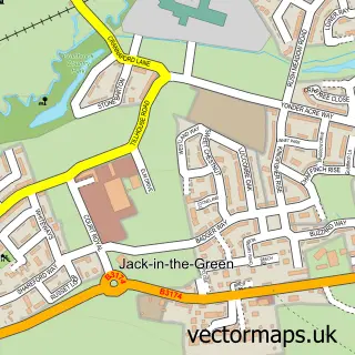
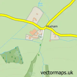
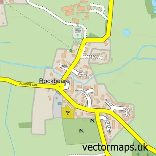
This West Clyst street map is a detailed vector street map covering a 750m x 750m area. Select a larger area to create and download your own vector street map of West Clyst.
The 750-metre map sample for West Clyst covers 433 mapped buildings and approximately 15.1 km of road detail, of which 25 named roads are named. The immediate area includes 1 school, 4 GP surgeries within 2 miles and 13 MOT stations within 2 miles. The wider area around West Clyst features 2 tourism points of interest and 1 food and drink venue. To create a larger or custom map of West Clyst, the map builder lets you define your own coverage area and download editable SVG, PDF and PNG files.
Create a larger editable map of West Clyst
Choose any area you need and generate a high-quality vector map instantly. Perfect for print, planning, design, business and personal use.

This West Clyst street map in Devon is available as downloadable SVG, PDF and PNG map files, or as a printed map for planning, business, display, education, local information and design work. You can also create a larger custom map area using the map selector.
What this West Clyst map sample shows
West Clyst lies within Devon County parish, part of Pinhoe ward in the Exeter District (B) local authority area. The postcode geography for this area includes the EX postcode area, the EX1 postcode district and the EX1 3 postcode sector. Residents fall under the Nhs Devon Integrated Care Board for NHS services.
Local features near West Clyst
Within 2 milesAmenities and services in and around West Clyst.
Administrative and postcode information for West Clyst
The local authority covering West Clyst is Exeter District (B), within the county of Devon. The settlement lies within Pinhoe ward and Devon County civil parish. The EX1 postcode district and EX1 3 postcode sector serve the immediate area. NHS provision in the area is delivered through Royal Devon University Healthcare Nhs Foundation Trust.
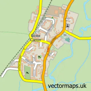
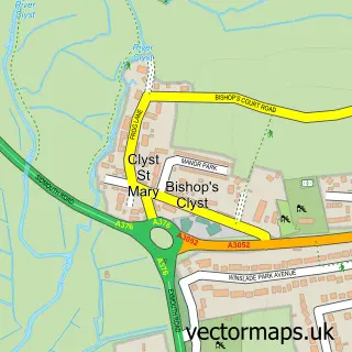
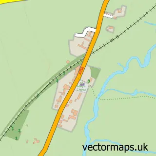
Nearby street map samples around West Clyst

More street maps in Devon
750 metre map area coverage
Boundary, postcode and point of interest information for the 750m x 750m rectangle centred on this sample map.
Boundaries containing map centre
Constituency: Exmouth and Exeter East Co Const
County: Devon County
District: East Devon District
Icb: NHS Devon ICB
Parish: Broad Clyst CP
Police Force: devon and cornwall
Postcode District: EX1
Postcode Sector: EX1 3
Ward: Broadclyst Ward
Nearby boundaries intersecting sample
District: Exeter District (B)
Postcode District: EX4, EX5
Postcode Sector: EX4 0, EX4 9, EX5 3
Ward: Exe Valley Ward, Pinhoe Ward
Postcode coverage
POI category counts
Landmark And Historical Building: 2
Pet Store: 2
Assisted Living Facility: 1
Coffee Shop: 1
Convenience Store: 1
Elementary School: 1
Hair Salon: 1
Home Cleaning: 1
Home Developer: 1
Professional Services: 1
Sample points of interest
- Alexander House Care Home
- Costa Express
- Co-op Food
- Westclyst Community Primary School
- Eleven Hair and Beauty
- MA Vernon Ltd
- Redrow - Saxon Brook
- Bunker LaserTag
- West Clyst
- Exe Valley Pet Foods
- Heart Pet Supplies
- Bruadair Consultancy and Training
Create a larger editable map of West Clyst
This sample shows only a 750 metre area. To create a larger map of West Clyst, use our map builder to choose your own coverage area, add titles and download editable SVG, PDF and PNG files.
Create a custom map of West Clyst