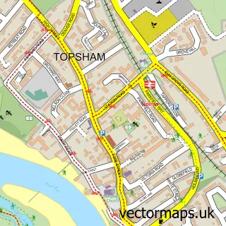
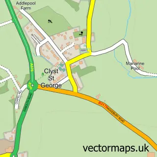
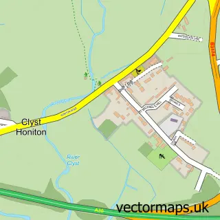
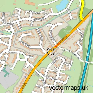
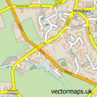
This Clyst St Mary street map is a detailed vector street map covering a 750m x 750m area. Select a larger area to create and download your own vector street map of Clyst St Mary.
The 750-metre map sample for Clyst St Mary covers 154 mapped buildings and approximately 12.7 km of road detail, of which 8 named roads are named. The immediate area includes 1 school, 4 GP surgeries within 2 miles, 2 pubs and 1 MOT station, with 12 within 2 miles. The wider area around Clyst St Mary features 3 food and drink venues and 2 campsites within 2 miles. To create a larger or custom map of Clyst St Mary, the map builder lets you define your own coverage area and download editable SVG, PDF and PNG files.
Create a larger editable map of Clyst St Mary
Choose any area you need and generate a high-quality vector map instantly. Perfect for print, planning, design, business and personal use.

This Clyst St Mary street map in Devon is available as downloadable SVG, PDF and PNG map files, or as a printed map for planning, business, display, education, local information and design work. You can also create a larger custom map area using the map selector.
What this Clyst St Mary map sample shows
Clyst St Mary lies within Clyst St. Mary Cp parish, part of Clyst Valley ward in the East Devon District local authority area. The postcode geography for this area includes the EX postcode area, the EX5 postcode district and the EX5 1 postcode sector. Residents fall under the Nhs Devon Integrated Care Board for NHS services.
Local features near Clyst St Mary
Within 2 milesAmenities and services in and around Clyst St Mary.
Administrative and postcode information for Clyst St Mary
Clyst St Mary lies within Clyst St. Mary Cp parish, part of Clyst Valley ward in the East Devon District local authority area. The postcode geography for this area includes the EX postcode area, the EX5 postcode district and the EX5 1 postcode sector. Residents fall under the Nhs Devon Integrated Care Board for NHS services.
Nearby street map samples around Clyst St Mary

More street maps in Devon
750 metre map area coverage
Boundary, postcode and point of interest information for the 750m x 750m rectangle centred on this sample map.
Boundaries containing map centre
Constituency: Exmouth and Exeter East Co Const
County: Devon County
District: East Devon District
Icb: NHS Devon ICB
Parish: Sowton CP
Police Force: devon and cornwall
Postcode District: EX5
Postcode Sector: EX5 1
Ward: Clyst Valley Ward
Nearby boundaries intersecting sample
Parish: Clyst St. George CP, Clyst St. Mary CP
Postcode District: EX2, EX3
Postcode Sector: EX2 7, EX3 0
Postcode coverage
POI category counts
Building Supply Store: 3
Car Dealer: 2
Convenience Store: 2
Pub: 2
Accountant: 1
Architect: 1
Arts And Entertainment: 1
Beauty And Spa: 1
Business: 1
Church Cathedral: 1
Sample points of interest
- The fresh accountancy company
- South West Design Partnership
- Clyst Valley Football Club
- Lyre Hair & Beauty, Lifestyle Studio
- Building Services Projects UK
- Exe Build
- Project Management & Building E T C
- Jack Russell Coaching
- Rydon Car Sales Exeter
- Rydon Motors
- Bishops Clyst Parish Council
- Londis
Create a larger editable map of Clyst St Mary
This sample shows only a 750 metre area. To create a larger map of Clyst St Mary, use our map builder to choose your own coverage area, add titles and download editable SVG, PDF and PNG files.
Create a custom map of Clyst St Mary