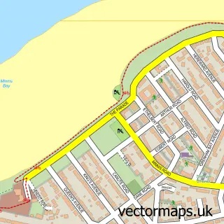
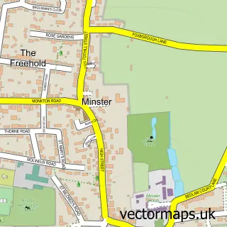
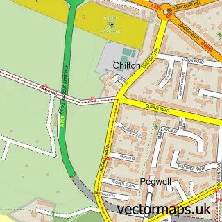
This Westgate-on-Sea street map is a detailed vector street map covering a 750m x 750m area. Select a larger area to create and download your own vector street map of Westgate-on-Sea.
The 750-metre map sample for Westgate-on-Sea covers 399 mapped buildings and approximately 19.4 km of road detail, of which 40 named roads are named. The immediate area includes 1 school, 1 railway station, 1 GP surgery, with 2 within 2 miles and 3 pubs among other local services. The wider area around Westgate-on-Sea features 2 tourism points of interest, 11 food and drink venues and 2 hotels. To create a larger or custom map of Westgate-on-Sea, the map builder lets you define your own coverage area and download editable SVG, PDF and PNG files.
Create a larger editable map of Westgate-on-Sea
Choose any area you need and generate a high-quality vector map instantly. Perfect for print, planning, design, business and personal use.

This Westgate-on-Sea street map in Kent is available as downloadable SVG, PDF and PNG map files, or as a printed map for planning, business, display, education, local information and design work. You can also create a larger custom map area using the map selector.
What this Westgate-on-Sea map sample shows
Westgate-on-Sea lies within Westgate-On-Sea Cp parish, part of Westgate-On-Sea ward in the Thanet District local authority area. The postcode geography for this area includes the CT postcode area, the CT8 postcode district and the CT8 8 postcode sector. Residents fall under the Nhs Kent And Medway Integrated Care Board for NHS services.
Local features near Westgate-on-Sea
Within 2 milesAmenities and services in and around Westgate-on-Sea.
Administrative and postcode information for Westgate-on-Sea
The local authority covering Westgate-on-Sea is Thanet District, within the county of Kent. The settlement lies within Westgate-On-Sea ward and Westgate-On-Sea Cp civil parish. The CT8 postcode district and CT8 8 postcode sector serve the immediate area. NHS provision in the area is delivered through East Kent Hospitals University Nhs Foundation Trust.
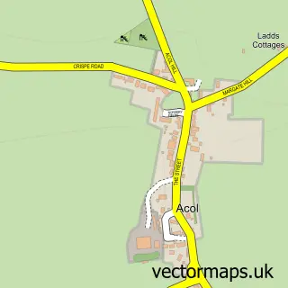
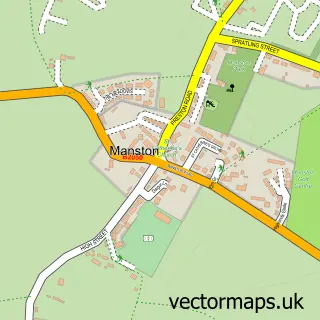
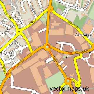
Nearby street map samples around Westgate-on-Sea

More street maps in Kent
750 metre map area coverage
Boundary, postcode and point of interest information for the 750m x 750m rectangle centred on this sample map.
Boundaries containing map centre
Constituency: Herne Bay and Sandwich Co Const
County: Kent County
District: Thanet District
Icb: NHS Kent and Medway ICB
Parish: Westgate-on-Sea CP
Police Force: kent
Postcode District: CT8
Postcode Sector: CT8 8
Ward: Westgate-on-Sea Ward
Nearby boundaries intersecting sample
No additional intersecting boundaries found.
Postcode coverage
POI category counts
Beauty Salon: 11
Real Estate Agent: 6
Retirement Home: 6
Cafe: 5
Tattoo And Piercing: 5
Bakery: 4
Convenience Store: 4
Elementary School: 4
General Dentistry: 4
Assisted Living Facility: 3
Sample points of interest
- One Three Four
- Saint Saviour's Parish Church
- St Saviour's
- RSPCA
- Brocante
- Westgate Galleria & Studio
- Westgate Gallery
- Tate Contempory Margate Kent
- Summerlands Lodge
- Windsor House
- Windsor Residential Care Home
- The Cooperative Food (BF) Westgate-On-Sea (ERF), Westgate on Sea
Create a larger editable map of Westgate-on-Sea
This sample shows only a 750 metre area. To create a larger map of Westgate-on-Sea, use our map builder to choose your own coverage area, add titles and download editable SVG, PDF and PNG files.
Create a custom map of Westgate-on-Sea